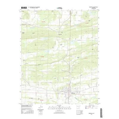
2017 Map of Booneville
USGS Topo · Published 2017About this map
Booneville serves as the focal point of this Logan County landscape, situated at the base of the prominent Booneville Mtn and Backbone Mtn. The town’s organized grid, including streets such as W Main St and Riviera Dr, contrasts with the winding valleys to the north. Further north, the settlement of Chismville is tucked between Fox Valley and Ferguson Valley, an area defined by several small-scale reservoirs including Sixmile Cr Watershed Site 7 Reservoir.
Find a feature on this map
127 named features on this map. Tap any name to fly to it.
Don’t see what you’re looking for? This feature index may not catch every label — zoom into the map to look around manually.
Map Details
Editions of this 2017 Booneville Map
This is the sole edition of this map. No revisions or reprints were ever made.
Other maps of this area

1887 · Magazine Mountain #2
USGS Topo · 1:62,500

1887 · Magazine Mountain #3
USGS Topo · 1:62,500

1887 · Magazine Mountain
USGS Topo · 1:62,500

1890 · Magazine Mountain
USGS Topo · 1:125,000

1890 · Fort Smith
USGS Topo · 1:125,000

1906 · Lavaca
USGS Topo · 1:62,500

1906 · Barber
USGS Topo · 1:62,500

1934 · Booneville
USGS Topo · 1:48,000

1939 · Booneville
USGS Topo · 1:62,500

1943 · Fort Smith
USGS Topo · 1:125,000