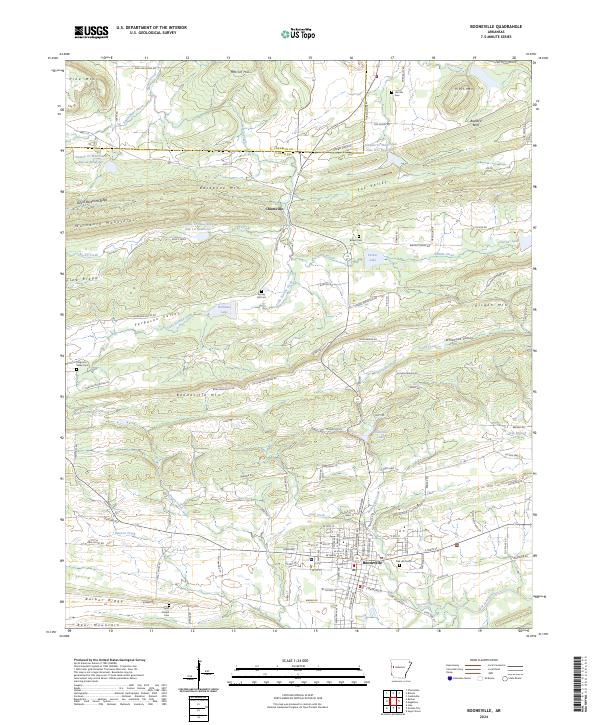
2024 Map of Booneville
USGS Topo · Published 2024About this map
Booneville sits at the foot of Booneville Mtn, serving as a central hub for Logan County in this modern-day representation of the region. The landscape is defined by the east-west orientation of the Washburn Mountains and the Devils Backbone Ridge, which separate the various creek valleys. Numerous family and community landmarks are scattered throughout the hills, including Oak Hill Cem and Spring Hill Cem, reflecting the deep-rooted local heritage.
Find a feature on this map
131 named features on this map. Tap any name to fly to it.
Don’t see what you’re looking for? This feature index may not catch every label — zoom into the map to look around manually.
Map Details
Editions of this 2024 Booneville Map
This is the sole edition of this map. No revisions or reprints were ever made.
Other maps of this area

1887 · Magazine Mountain #2
USGS Topo · 1:62,500

1887 · Magazine Mountain #3
USGS Topo · 1:62,500

1887 · Magazine Mountain
USGS Topo · 1:62,500

1890 · Magazine Mountain
USGS Topo · 1:125,000

1890 · Fort Smith
USGS Topo · 1:125,000

1906 · Lavaca
USGS Topo · 1:62,500

1906 · Barber
USGS Topo · 1:62,500

1934 · Booneville
USGS Topo · 1:48,000

1939 · Booneville
USGS Topo · 1:62,500

1943 · Fort Smith
USGS Topo · 1:125,000