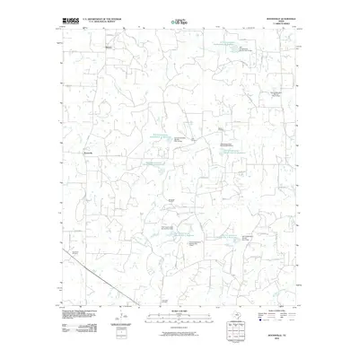
2010 Map of Boonsville
USGS Topo · Published 2010About this map
Boonsville and Balsora serve as the primary residential hubs in this part of Wise County, reflecting a landscape defined by ranching and resource extraction. The northern reach is punctuated by the Boonsville Gas Field, an indicator of the region's energy industry. This 2010 survey highlights a sophisticated network of water management, visible through numerous Soil Conservation Service installations such as Soil Conservation Service Site 22 Reservoir and the Soil Conservation Service Site 1 Dam. These reservoirs are critical to managing the flow of local waterways like Garrett Creek, Salt Creek, and Willow Creek. Local history is anchored by several rural burial grounds, including Gillie Cemetery, Bethel Cemetery, and Friendship Cemetery, which remain scattered among the section lines and farm roads. The road network, including FM 920 and FM 2210, connects these remote settlements across a terrain of creeks and minor branches like Oxford Water Branch.
Find a feature on this map
59 named features on this map. Tap any name to fly to it.
Don’t see what you’re looking for? This feature index may not catch every label — zoom into the map to look around manually.
Map Details
Editions of this 2010 Boonsville Map
This is the sole edition of this map. No revisions or reprints were ever made.
Other maps of this area

1891 · Weatherford
USGS Topo · 1:125,000

1893 · Weatherford
USGS Topo · 1:125,000

1930 · Boyd
USGS Topo · 1:62,500

1932 · Springtown
USGS Topo · 1:62,500

1954 · Dallas
USGS Topo · 1:250,000

1954 · Sherman
USGS Topo · 1:250,000

1958 · Dallas
USGS Topo · 1:250,000

1958 · Sherman
USGS Topo · 1:250,000

1958 · Springtown
USGS Topo · 1:24,000
1959 · Adell
USGS Topo · 1:24,000