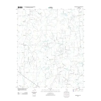
2013 Map of Boonsville
USGS Topo · Published 2013About this map
Boonsville and Balsora anchor this rural landscape in Wise County, characterized by a complex network of waterways and extensive water management infrastructure. The terrain is defined by the drainage of Garrett Cr, Salt Cr, and Willow Cr, which are punctuated by numerous reservoirs constructed by the Soil Conservation Service. These include Site 15 Reservoir and Site 22 Reservoir, illustrating the mid-century push for flood control and water conservation in North Texas. The economic character of the region is further marked by the Boonsville Gas Field, while local genealogy is rooted in sites like Bethel Cem, Gillie Cem, and Friendship Cem. A dense grid of county roads and family-named private drives provides access to the dispersed farmsteads and energy resources of this prairie region.
Find a feature on this map
70 named features on this map. Tap any name to fly to it.
Don’t see what you’re looking for? This feature index may not catch every label — zoom into the map to look around manually.
Map Details
Editions of this 2013 Boonsville Map
This is the sole edition of this map. No revisions or reprints were ever made.
Other maps of this area

1891 · Weatherford
USGS Topo · 1:125,000

1893 · Weatherford
USGS Topo · 1:125,000

1930 · Boyd
USGS Topo · 1:62,500

1932 · Springtown
USGS Topo · 1:62,500

1954 · Dallas
USGS Topo · 1:250,000

1954 · Sherman
USGS Topo · 1:250,000

1958 · Dallas
USGS Topo · 1:250,000

1958 · Sherman
USGS Topo · 1:250,000

1958 · Springtown
USGS Topo · 1:24,000
1959 · Adell
USGS Topo · 1:24,000