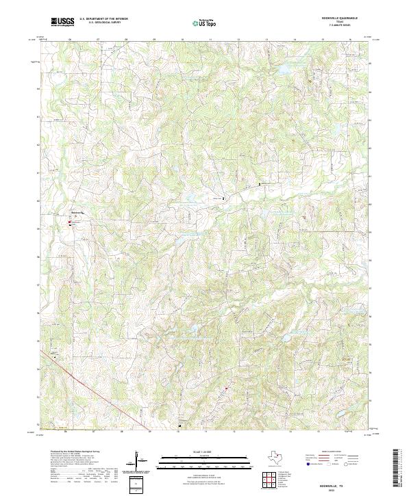
2022 Map of Boonsville
USGS Topo · Published 2022About this map
Boonsville serves as the primary settlement hub for this corner of Wise County, where rural life is defined by a landscape of creeks and small-scale water management. The terrain is marked by numerous Soil Conservation Service reservoirs, including Site 12 and Site 4, which manage the drainage of waterways like Garrett Creek and South Fork Rush Creek. For genealogists and local historians, the area is notably rich in burial grounds, featuring the Boonsville Cemetery in town, and more remote locations like Oxford Water Cemetery, Friendship Cemetery, and the Gilley Cemetery. The road network, primarily composed of Farm to Market roads like FM 920 and FM 2210, connects these scattered homesteads and landmarks across a topography shaped by Salt Creek and the Oxford Water Branch.
Find a feature on this map
104 named features on this map. Tap any name to fly to it.
Don’t see what you’re looking for? This feature index may not catch every label — zoom into the map to look around manually.
Map Details
Editions of this 2022 Boonsville Map
This is the sole edition of this map. No revisions or reprints were ever made.
Other maps of this area

1891 · Weatherford
USGS Topo · 1:125,000

1893 · Weatherford
USGS Topo · 1:125,000

1930 · Boyd
USGS Topo · 1:62,500

1932 · Springtown
USGS Topo · 1:62,500

1954 · Dallas
USGS Topo · 1:250,000

1954 · Sherman
USGS Topo · 1:250,000

1958 · Dallas
USGS Topo · 1:250,000

1958 · Sherman
USGS Topo · 1:250,000

1958 · Springtown
USGS Topo · 1:24,000
1959 · Adell
USGS Topo · 1:24,000