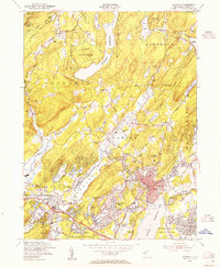
1954 Map of Boonton
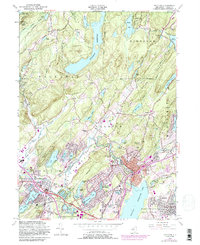
USGS Topo · Published 1988About this map
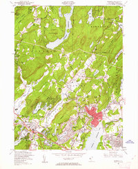
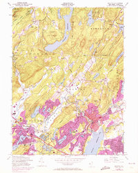
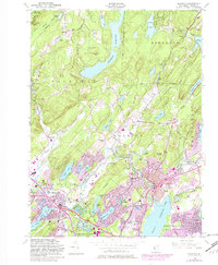
Splitrock Reservoir and the Boonton Reservoir dominate the landscape of Morris County in this mid-century topographic survey, illustrating a region defined by its critical water resources and post-war suburban expansion. The map details the transition from the secluded terrain of the Kinnelon Mountains and Farny State Park to the established residential grids of Boonton and Mountain Lakes. Transportation networks are in a state of flux, with the Conrail lines serving the industrial corridor while other segments are noted as abandoned. A significant portion of the western edge is occupied by the U.S. Military Reservation (Picatinny Arsenal), a massive federal installation that shaped local development. Local heritage is preserved through numerous family and community sites, including Marcella Cem, Union Ch, and the Scott Cem, marking the early settlements of Hibernia and Marcella before the era of widespread lake-community development.
Find a feature on this map
102 named features on this map. Tap any name to fly to it.
Don’t see what you’re looking for? This feature index may not catch every label — zoom into the map to look around manually.
Map Details
Editions of this 1954 Boonton Map
6 editions found

Other maps of this area

1888 · Franklin
USGS Topo · 1:62,500

1888 · Morristown
USGS Topo · 1:62,500

1888 · Lake Hopatcong
USGS Topo · 1:62,500

1891 · Greenwood Lake
USGS Topo · 1:62,500

1893 · Greenwood Lake
USGS Topo · 1:62,500

1894 · Morristown
USGS Topo · 1:62,500

1894 · Lake Hopatcong
USGS Topo · 1:62,500

1894 · Franklin
USGS Topo · 1:62,500

1897 · Franklin
USGS Topo · 1:62,500

1898 · Lake Hopatcong
USGS Topo · 1:62,500
Featured Places
- Parsippany-Troy Hills, NJ
- Rockaway Township, NJ
- Montville Township, NJ
- Denville, NJ
- Denville Township, Denville