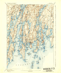
1893 Map of Boothbay
USGS Topo · Published 1941About this map
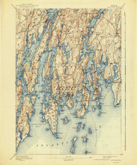
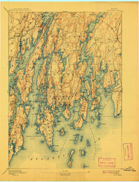
The mid-coast Maine archipelago is defined here by its complex tidal rivers and deep-water harbors as they appeared in the early 1890s. The Maine Central RR cuts across the northern edge near South Newcastle, while the rest of the landscape remains deeply connected to the sea. Coastal life centers on the bustling maritime hub of Boothbay Harbor and the numerous inlets like Christmas Cove and Ebenecook Harbor. These waters supported a diverse economy of fishing, shipping, and resource extraction, evidenced by a Quarry on Oak Id. and the strategic placement of navigational aids including Pemaquid Pt. Light, Burnt Id. Light, and Hendricks Head Light. Inland, the high ground of Cushman Hill and Keniston Hill overlooks the braided channels of the Sheepscot River and Damariscotta River, which separate the long peninsulas and islands like Barters Island from the mainland.
Find a feature on this map
140 named features on this map. Tap any name to fly to it.
Don’t see what you’re looking for? This feature index may not catch every label — zoom into the map to look around manually.
Map Details
Editions of this 1893 Boothbay Map
11 editions found

1893 edition
15.1 x 20.1 inches
1901 edition
15.6 x 20.3 inches
1905 edition
15.6 x 20.3 inches
1906 edition
15.6 x 20.5 inches
1908 edition
15.6 x 20.3 inches
1909 edition
15.6 x 20.3 inches
1911 edition
15.8 x 19.5 inches
1921 edition
15.5 x 20.2 inches

1930 edition
15.6 x 20.3 inches
1936 edition
16.5 x 19.8 inches
1941 edition
16.5 x 19.8 inches
Other maps of this area

1892 · Gardiner
USGS Topo · 1:62,500

1893 · Small Point
USGS Topo · 1:62,500

1893 · Wiscasset
USGS Topo · 1:62,500
1893 · Boothbay
USGS Topo · 1:62,500

1894 · Bath
USGS Topo · 1:62,500

1904 · Monhegan
USGS Topo · 1:62,500

1906 · Monhegan
USGS Topo · 1:62,500

1913 · Waldoboro
USGS Topo · 1:48,000

1915 · Waldoboro
USGS Topo · 1:62,500

1919 · Small Point
USGS Topo · 1:62,500