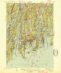
1944 Map of Boothbay
USGS Topo · Published 1944About this map
Fort Edgecomb stands at the northern entrance of this coastal landscape, overlooking The Eddy during the mid-1940s. The region is defined by a complex network of narrow peninsulas and sheltered harbors, where the Johns River and Pemaquid River meet the Atlantic. Settlement patterns follow these marine corridors, from the village at Boothbay Harbor to smaller outposts like New Harbor and Pemaquid Beach. The interior contains numerous local landmarks vital for genealogical research, including Woodlawn Cem, Oaklawn Cem, and the Washington Sch.
Find a feature on this map
248 named features on this map. Tap any name to fly to it.
Don’t see what you’re looking for? This feature index may not catch every label — zoom into the map to look around manually.
Map Details
Editions of this 1944 Boothbay Map
2 editions found

Other maps of this area

1892 · Gardiner
USGS Topo · 1:62,500

1893 · Small Point
USGS Topo · 1:62,500

1893 · Wiscasset
USGS Topo · 1:62,500

1893 · Boothbay
USGS Topo · 1:62,500

1894 · Bath
USGS Topo · 1:62,500

1904 · Monhegan
USGS Topo · 1:62,500

1906 · Monhegan
USGS Topo · 1:62,500

1913 · Waldoboro
USGS Topo · 1:48,000

1915 · Waldoboro
USGS Topo · 1:62,500

1919 · Small Point
USGS Topo · 1:62,500