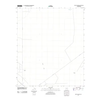
2010 Map of Bootleg Ridge
USGS Topo · Published 2010About this map
Sand Dunes Oil Field and Triste Draw Oil Field define the industrial character of this desert landscape in Lea County. The terrain is marked by the namesake Bootleg Ridge, a subtle topographic rise in an otherwise arid expanse. Transportation through the region relies on a sparse network of local routes, primarily County Rd-798 and County Rd-31, which connect the scattered petroleum extraction sites. Water sources are scarce, represented here by the lone Hayfield Tank in the northern portion of the quadrangle. This 2010 survey by the U.S. Geological Survey documents the infrastructure of the Permian Basin at the start of the 21st century, showing how the oil and gas industry has mapped and utilized this remote New Mexico territory.
Find a feature on this map
6 named features on this map. Tap any name to fly to it.
Don’t see what you’re looking for? This feature index may not catch every label — zoom into the map to look around manually.
Map Details
Editions of this 2010 Bootleg Ridge Map
This is the sole edition of this map. No revisions or reprints were ever made.
Other maps of this area

1939 · Nash Draw
USGS Topo · 1:62,500

1943 · Nash Draw
USGS Topo · 1:62,500

1954 · Hobbs
USGS Topo · 1:250,000

1958 · Hobbs
USGS Topo · 1:250,000

1963 · Hat Mesa
USGS Topo · 1:62,500
1968 · Big Sinks
USGS Topo · 1:24,000

1973 · Bell Lake
USGS Topo · 1:24,000

1973 · Paduca Breaks NW
USGS Topo · 1:24,000

1978 · Jal
USGS Topo · 1:100,000
1984 · Tip Top Wells
USGS Topo · 1:24,000