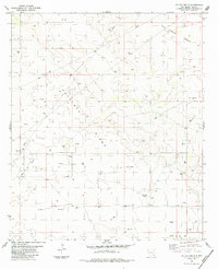
1984 Map of Tip Top Wells
USGS Topo · Published 1984About this map
Antelope Ridge and the surrounding high desert of Lea County dominate this landscape, defined by a mid-century boom in resource extraction. The area shows a transition from traditional ranching to an industrial energy economy, evidenced by the Cruz Oil Field and the numerous Oil Well and Gas Well symbols scattered across the terrain. While older landmarks like Brinninstool Ranch and Allred Well indicate the importance of water and livestock in this arid environment, the emergence of a complex Pipeline network and multiple Gravel Pits reflects the infrastructure required for New Mexico's petroleum development.
Find a feature on this map
16 named features on this map. Tap any name to fly to it.
Don’t see what you’re looking for? This feature index may not catch every label — zoom into the map to look around manually.
Map Details
Editions of this 1984 Tip Top Wells Map
This is the sole edition of this map. No revisions or reprints were ever made.
Other maps of this area

1954 · Hobbs
USGS Topo · 1:250,000

1958 · Hobbs
USGS Topo · 1:250,000

1963 · Oil Center
USGS Topo · 1:62,500

1963 · Hat Mesa
USGS Topo · 1:62,500

1973 · Bell Lake
USGS Topo · 1:24,000

1973 · Paduca Breaks NW
USGS Topo · 1:24,000
1973 · Woodley Flat
USGS Topo · 1:24,000

1978 · Jal
USGS Topo · 1:100,000
1984 · Grama Ridge
USGS Topo · 1:24,000
1984 · San Simon Sink
USGS Topo · 1:24,000