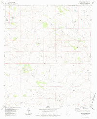
1984 Map of Grama Ridge
USGS Topo · Published 1984About this map
Gorama Ridge dominates the high ground of this Southeastern New Mexico landscape, marking a transition between the elevated Hat Mesa and the broad depressions to the south. The mapping reveals a land defined by industrial exploration and water management in a desert environment, with numerous Drill Hole sites and an extensive Pipeline network spanning the terrain. Small, specialized settlements such as Eaves Wells, Standard Wells, and Rogers Wells suggest a history of ranching and resource extraction dependent on localized water sources. To the south, the terrain falls away into the San Simon Swale, where natural and man-made water features like Dagger Lake and various Tanks provided essential hubs for local activity. A network of Jeep Trails provides the primary means of navigating this remote portion of Lea County.
Find a feature on this map
17 named features on this map. Tap any name to fly to it.
Don’t see what you’re looking for? This feature index may not catch every label — zoom into the map to look around manually.
Map Details
Editions of this 1984 Grama Ridge Map
This is the sole edition of this map. No revisions or reprints were ever made.
Other maps of this area

1954 · Hobbs
USGS Topo · 1:250,000

1958 · Hobbs
USGS Topo · 1:250,000

1963 · Oil Center
USGS Topo · 1:62,500

1963 · Monument
USGS Topo · 1:62,500

1963 · Laguna Gatuna
USGS Topo · 1:62,500

1963 · Hat Mesa
USGS Topo · 1:62,500

1978 · Jal
USGS Topo · 1:100,000

1984 · Lea
USGS Topo · 1:24,000
1984 · Tip Top Wells
USGS Topo · 1:24,000
1984 · San Simon Sink
USGS Topo · 1:24,000