
1984 Map of Lea
USGS Topo · Published 1984About this map
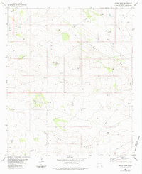
The Lea Oil Field and surrounding energy landscapes dominate this 1984 survey of the Querecho Plains. This portion of southeastern New Mexico is characterized by a dense network of industrial infrastructure, where numerous oil wells and an extensive pipeline system crisscross the arid terrain. The settlement of Lea sits amidst these operations, connected to the wider region by the Marathon Road and several rugged Jeep Trails.
Find a feature on this map
17 named features on this map. Tap any name to fly to it.
Don’t see what you’re looking for? This feature index may not catch every label — zoom into the map to look around manually.
Map Details
Editions of this 1984 Lea Map
This is the sole edition of this map. No revisions or reprints were ever made.
Other maps of this area

1954 · Hobbs
USGS Topo · 1:250,000

1958 · Hobbs
USGS Topo · 1:250,000

1963 · Oil Center
USGS Topo · 1:62,500

1963 · Monument
USGS Topo · 1:62,500

1963 · Laguna Gatuna
USGS Topo · 1:62,500

1963 · Hat Mesa
USGS Topo · 1:62,500

1978 · Jal
USGS Topo · 1:100,000

1984 · Ironhouse Well
USGS Topo · 1:24,000
1984 · Grama Ridge
USGS Topo · 1:24,000

1984 · Laguna Gatuna NW
USGS Topo · 1:24,000