
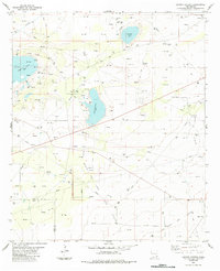
1984 Map of Laguna Gatuna NW
USGS Topo · Published 1984About this map
Querecho Plains dominates this section of Lea County, where industrial development and raw terrain intersect. In the mid-1980s, the landscape was defined by the energy sector, featuring the sprawling South Corbin Oil and Gas Field and both the West Tonto Oil Field and South Tonto Oil Field. The infrastructure required for extraction is visible in the dense network of Pipeline corridors and Aqueduct routes that crisscross the territory. Local resource extraction beyond petroleum is noted by scattered Gravel Pits, while navigation across the arid ground relied on a system of Jeep Trails. This map documents a specific phase of New Mexico petroleum history, capturing the exact placement of Water Tanks and wells that drove the local economy during this era of intensive field development.
Find a feature on this map
12 named features on this map. Tap any name to fly to it.
Don’t see what you’re looking for? This feature index may not catch every label — zoom into the map to look around manually.
Map Details
Editions of this 1984 Laguna Gatuna NW Map
This is the sole edition of this map. No revisions or reprints were ever made.
Other maps of this area

1942 · Clayton Basin
USGS Topo · 1:62,500

1943 · Clayton Basin
USGS Topo · 1:62,500

1954 · Hobbs
USGS Topo · 1:250,000

1958 · Hobbs
USGS Topo · 1:250,000

1962 · Buckeye
USGS Topo · 1:62,500

1963 · Laguna Gatuna
USGS Topo · 1:62,500

1963 · Maljamar
USGS Topo · 1:62,500

1984 · Lea
USGS Topo · 1:24,000

1984 · Ironhouse Well
USGS Topo · 1:24,000
1984 · Laguna Gatuna
USGS Topo · 1:24,000