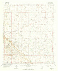
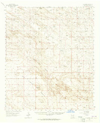
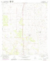
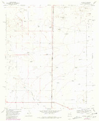
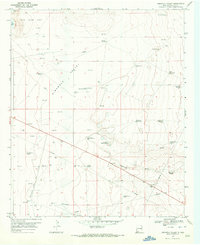
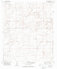
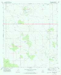
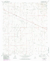
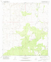
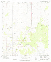
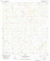
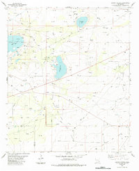
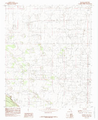
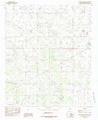
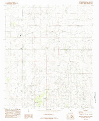
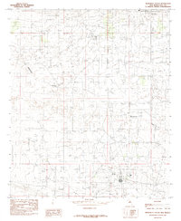
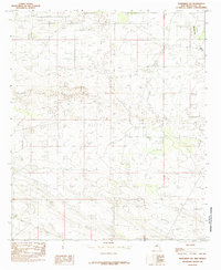
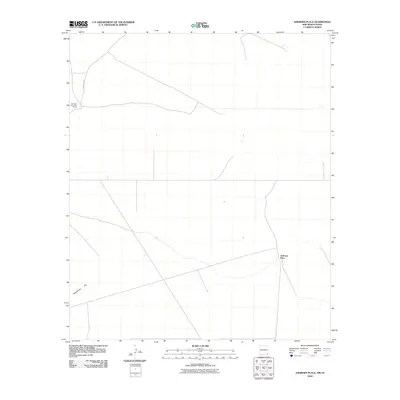
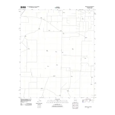
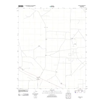
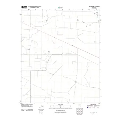
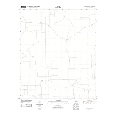
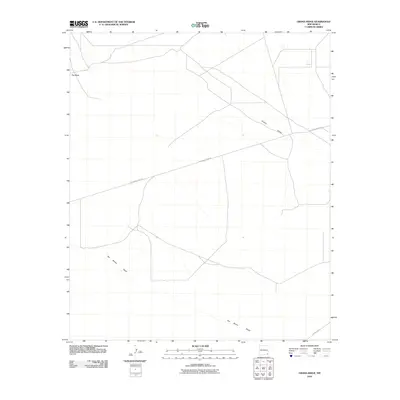
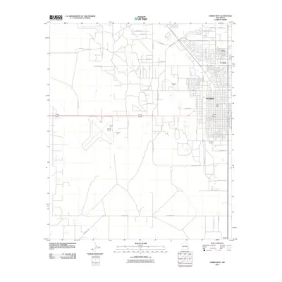
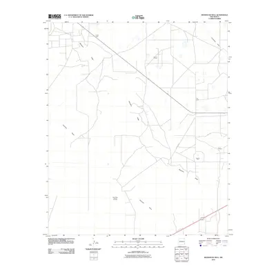
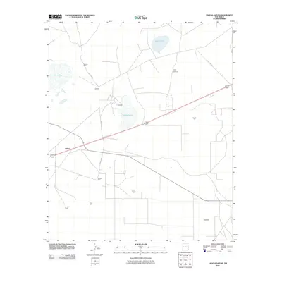
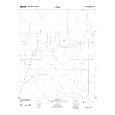
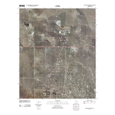
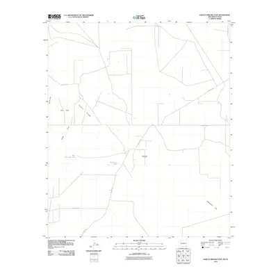
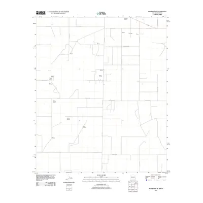
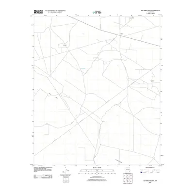
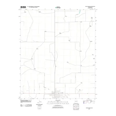
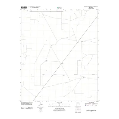
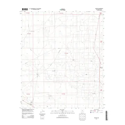
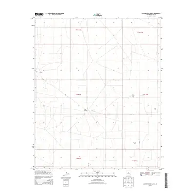
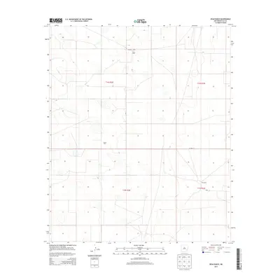
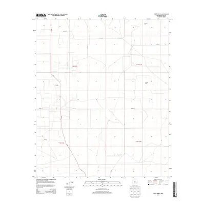
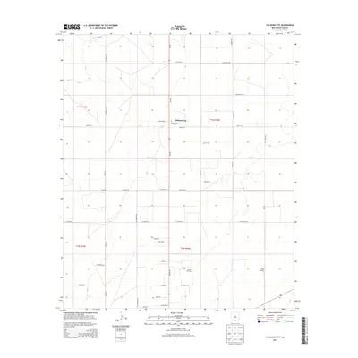
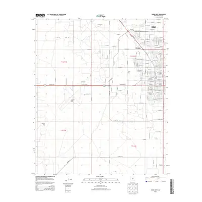
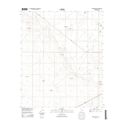
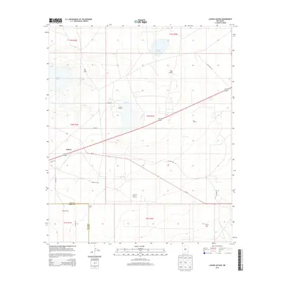
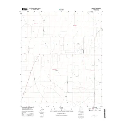
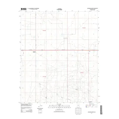
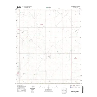
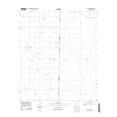
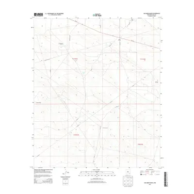
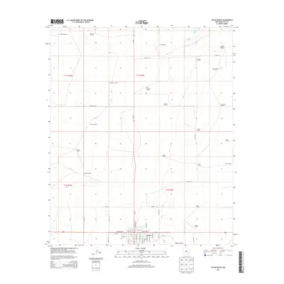
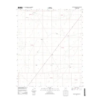
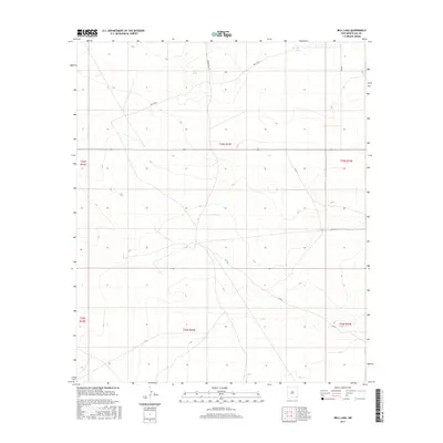
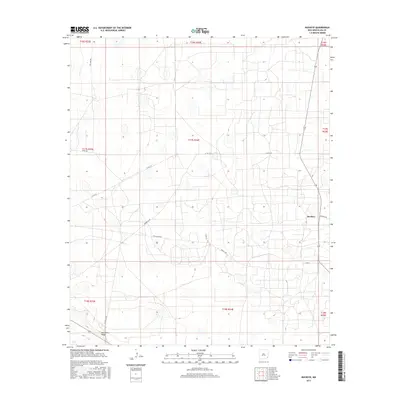
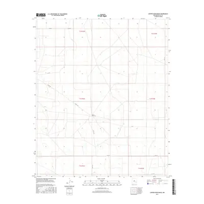
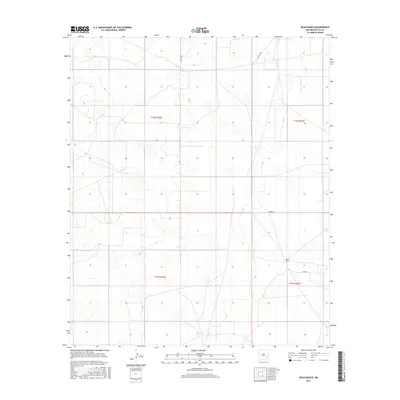
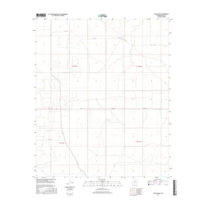
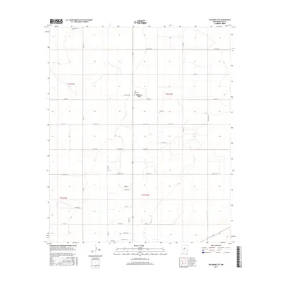
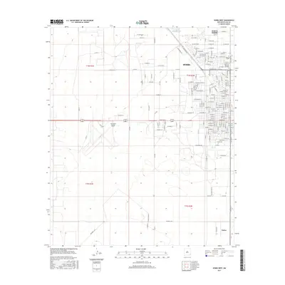
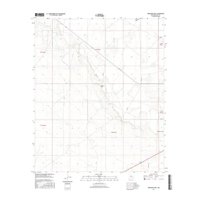
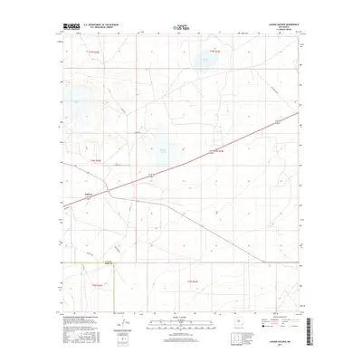
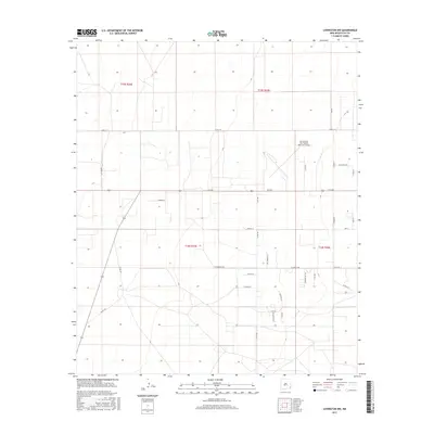
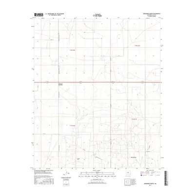
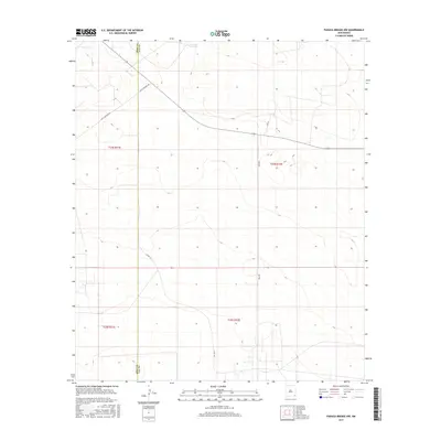
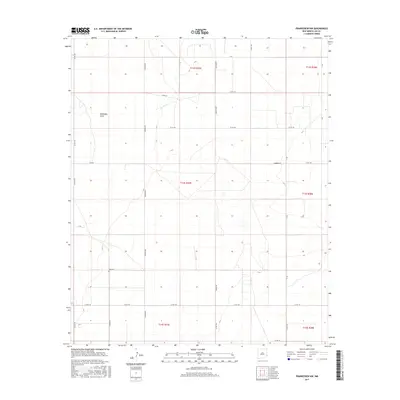
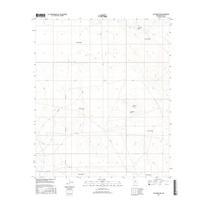
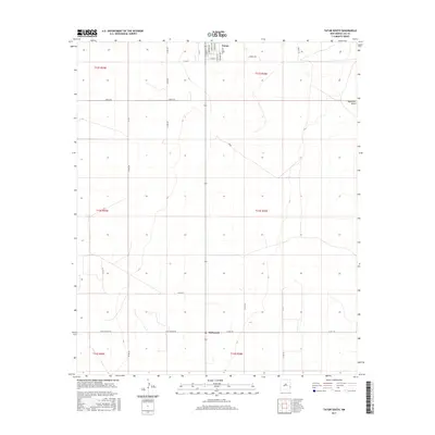
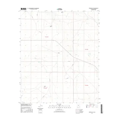
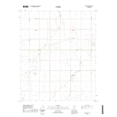
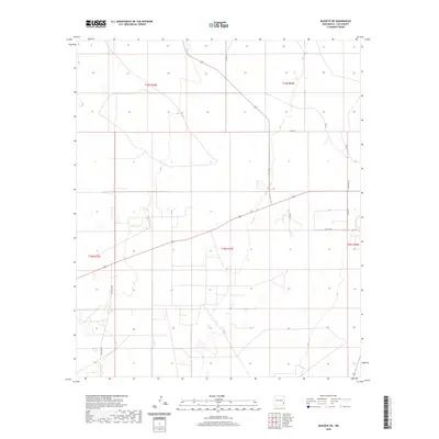
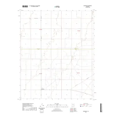
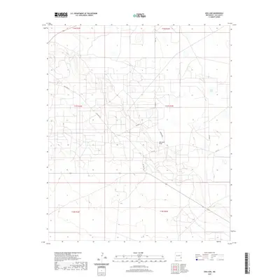
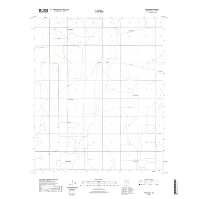
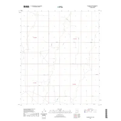
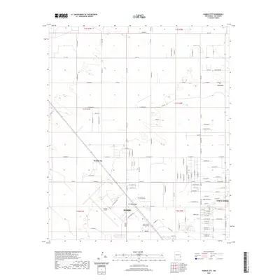
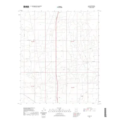
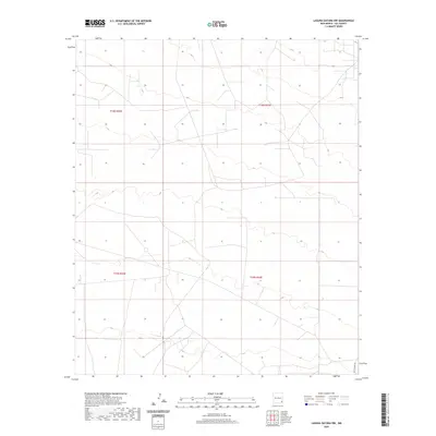
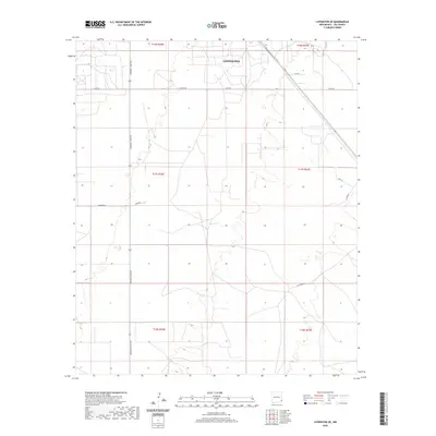
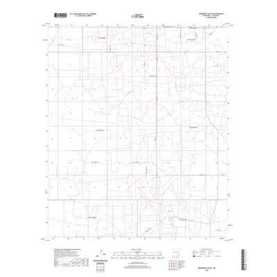
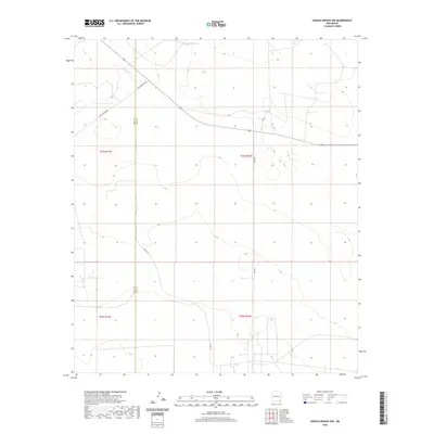
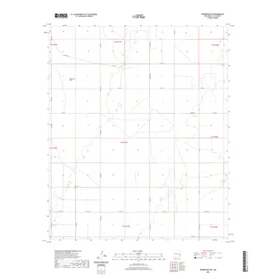
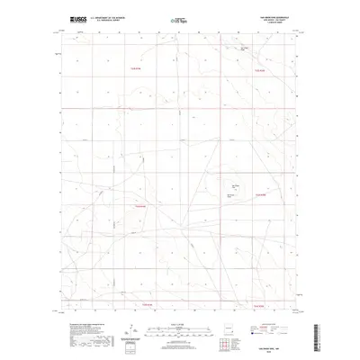
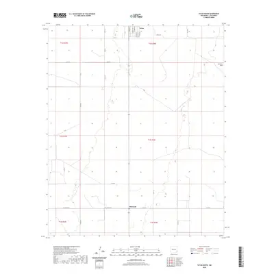
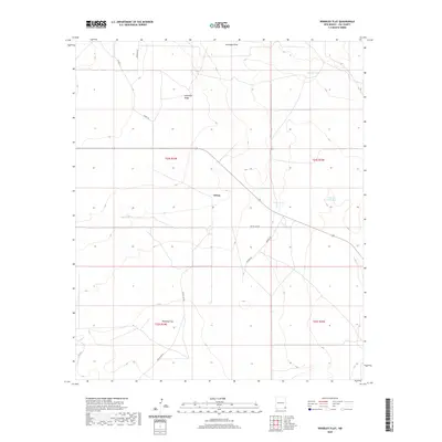
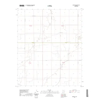
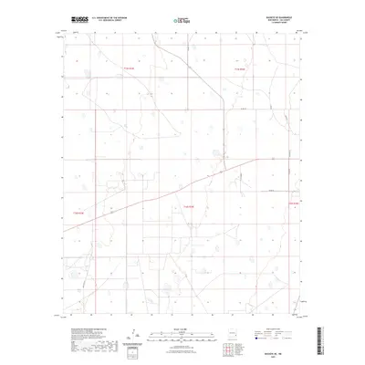
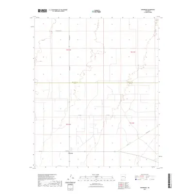
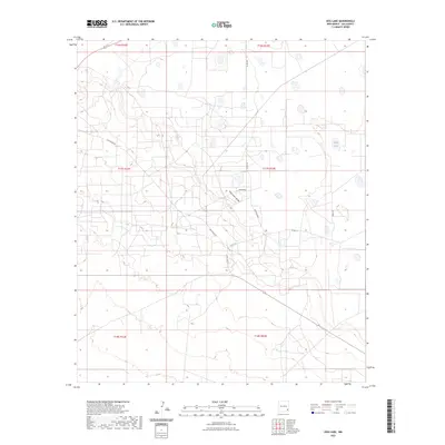
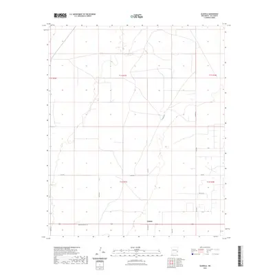
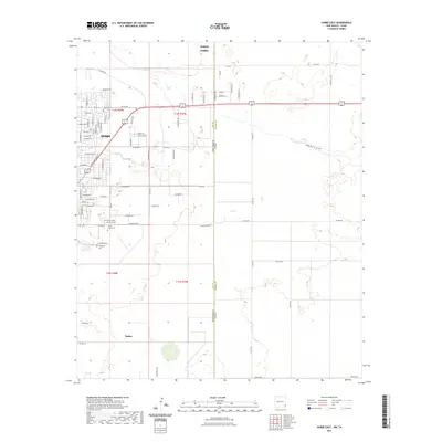
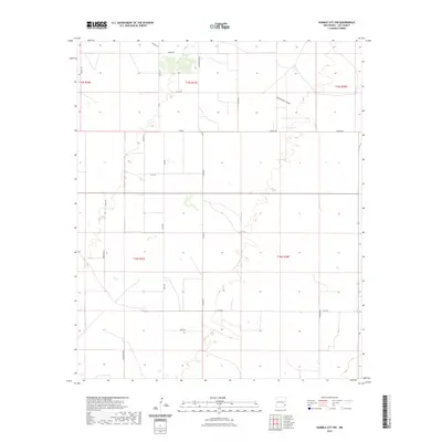
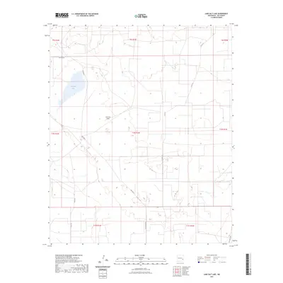
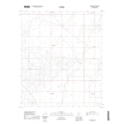
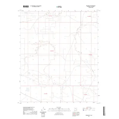
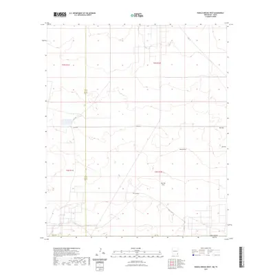
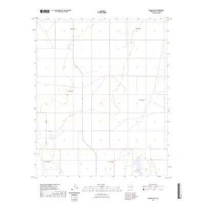
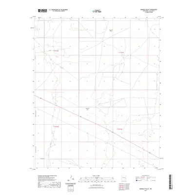
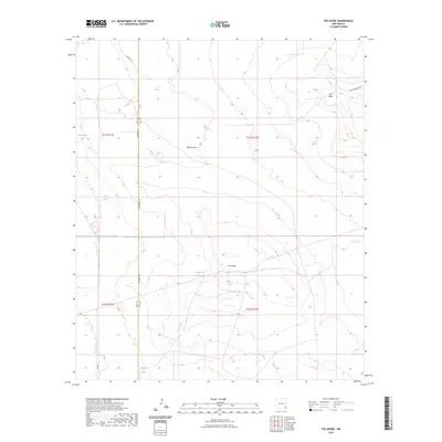
1962 Map of Buckeye
USGS Topo · Published 1965About this map
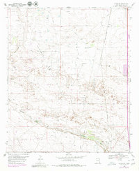
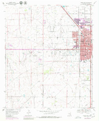
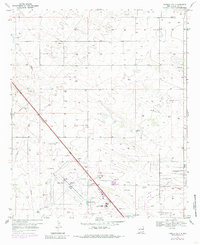
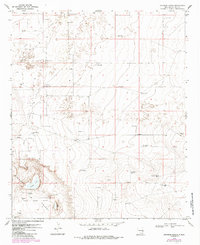
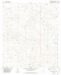
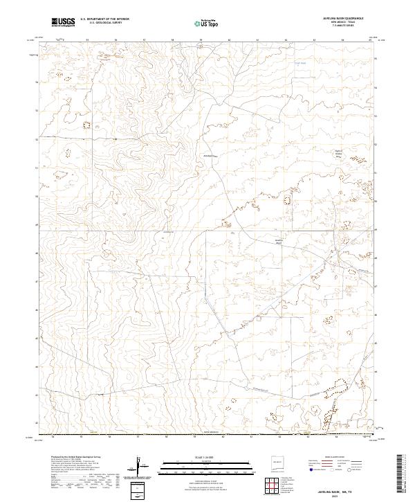
Mescalero Ridge and The Caprock define the rugged verticality of this 1962 landscape, where the high plains break away toward the Querecho Plains below. This survey captures the intensive petroleum development of mid-century Lea County, evidenced by the sprawling networks of the Vacuum Oil Field, Kemnitz Oil Field, and Leamex Oil Field. Amidst this industrial infrastructure, the map preserves the traditional ranching heritage of the region, documenting numerous family-held outposts like Edison Ranch, Paschall Ranch, and the Chambers Sheep Camp. The small settlement of Buckeye serves as a hub for the surrounding oil and cattle operations. Researchers can trace the sophisticated water and resource management of the era through the various aqueducts and pipelines that crisscross the arid terrain, connecting remote sites like White Lake to the active drilling zones.
Find a feature on this map
26 named features on this map. Tap any name to fly to it.
Don’t see what you’re looking for? This feature index may not catch every label — zoom into the map to look around manually.
Map Details
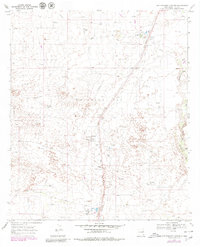
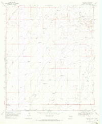
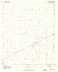
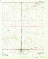
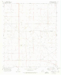
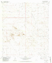
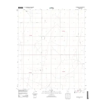
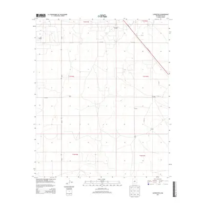
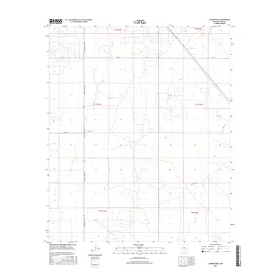
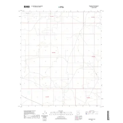
Editions of this 1962 Buckeye Map
This is the sole edition of this map. No revisions or reprints were ever made.
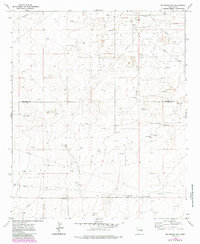
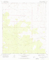
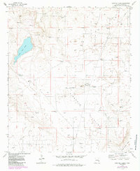
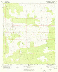
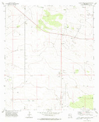
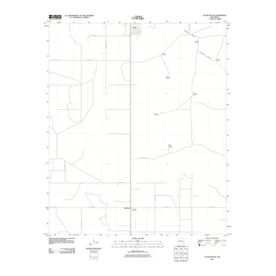
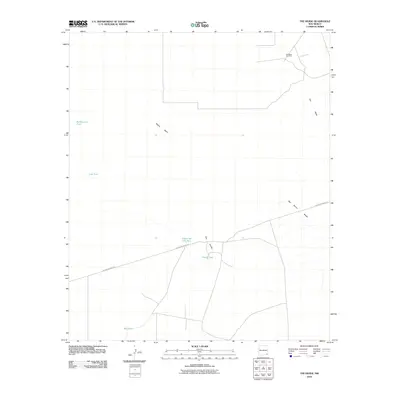
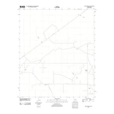
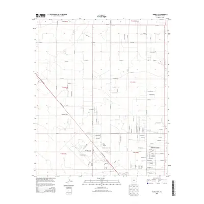
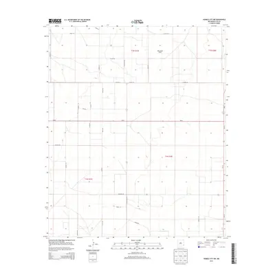
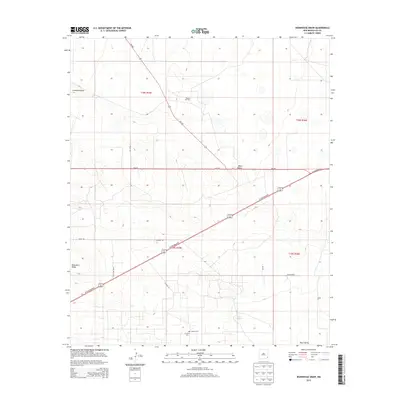
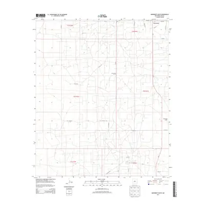
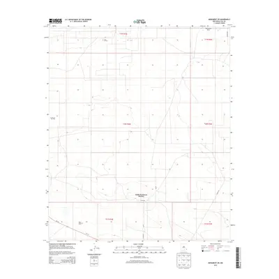
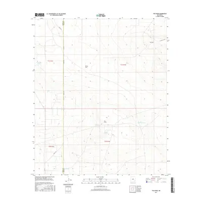
Historical Maps of Buckeye Through Time
388 maps found
1961 Johnson Ranch
Lea County, NM
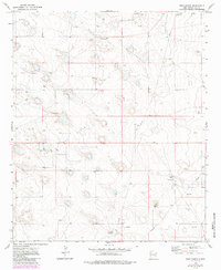
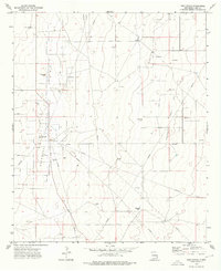
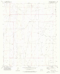
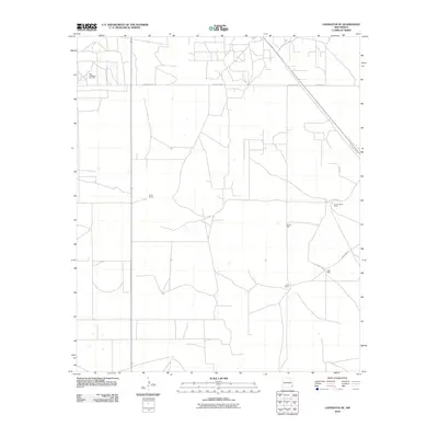
1962 Buckeye
Lea County, NM
1963 Hat Mesa
Lea County, NM
1963 Laguna Gatuna
Lea County, NM
1963 Oil Center
Lea County, NM
1969 Hobbs SW
Lea County, NM
1969 Hobbs West
Lea County, NM
1969 Humble City
Lea County, NM
1969 Jal NW
Lea County, NM
1969 Rattlesnake Canyon
Lea County, NM
1970 Alston Ranch
Lea County, NM
1970 Bronco NE
Lea County, NM
1970 Bronco
Lea County, NM
1970 Gladiola
Lea County, NM
1970 Hillburn City
Lea County, NM
1970 Hillburn City SW
Lea County, NM
1970 Johnson Ranch
Lea County, NM
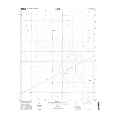
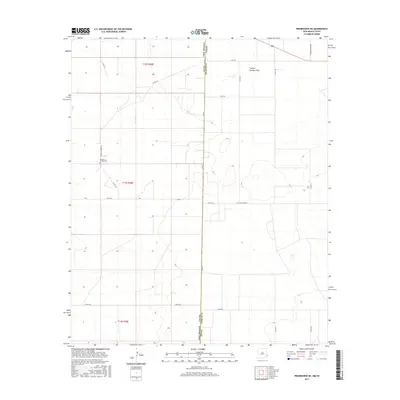
1970 Prairieview
Lea County, NM

1970 Prairieview NE
Lea County, NM
1970 Prairieview NW
Lea County, NM
1970 Ranger Lake
Lea County, NM
1970 Simanola Valley
Lea County, NM
1970 Tatum North
Lea County, NM
1970 Tatum South
Lea County, NM
1970 Walking Cane Ranch
Lea County, NM
1972 Bledsoe SW
Lea County, NM
1972 Crossroads
Lea County, NM
1972 Milnesand SW
Lea County, NM
1973 Andrews Place
Lea County, NM
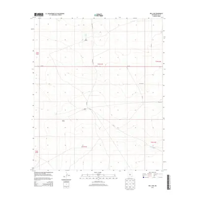
1973 Bell Lake
Lea County, NM
1973 Caprock
Lea County, NM
1973 Cooper-Good Ranch
Lea County, NM
1973 Custer Mountain
Lea County, NM
1973 Dallas Store NW
Lea County, NM
1973 Dean Ranch
Lea County, NM
1973 Fort Ranch
Lea County, NM
1973 Frier Ranch
Lea County, NM
1973 Javelina Basin
Lea County, NM
1973 Lane Salt Lake
Lea County, NM
1973 Paduca Breaks East
Lea County, NM
1973 Paduca Breaks NW
Lea County, NM
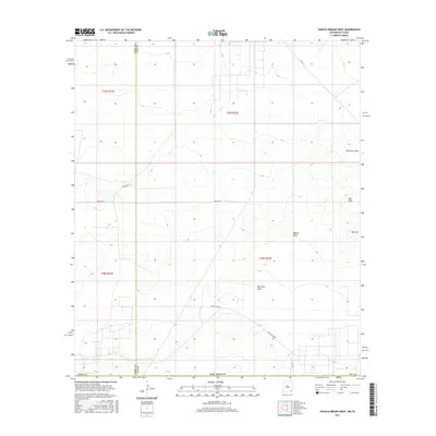
1973 Paduca Breaks West
Lea County, NM
1973 Soldier Hill
Lea County, NM
1973 Woodley Flat
Lea County, NM
1978 Flying M Ranch
Lea County, NM
1984 Bootleg Ridge
Lea County, NM
1984 East Lake
Lea County, NM
1984 Grama Ridge
Lea County, NM
1984 Ironhouse Well
Lea County, NM
1984 Laguna Gatuna
Lea County, NM
1984 Laguna Gatuna NW
Lea County, NM
1984 Lea
Lea County, NM
1984 Oil Center
Lea County, NM
1984 San Simon Ranch
Lea County, NM
1984 San Simon Sink
Lea County, NM
1984 The Divide
Lea County, NM
1984 Tip Top Wells
Lea County, NM
1985 Buckeye
Lea County, NM
1985 Buckeye NE
Lea County, NM
1985 Buckeye NW
Lea County, NM
1985 Dog Lake
Lea County, NM
1985 Ironhouse Draw
Lea County, NM
1985 Lovington NW
Lea County, NM
1985 Lovington SE
Lea County, NM
1985 Lovington SW
Lea County, NM
1985 Monument North
Lea County, NM
1985 Monument South
Lea County, NM
1985 Monument SW
Lea County, NM
2010 Alston Ranch
Lea County, NM
2010 Andrews Place
Lea County, NM
2010 Bell Lake
Lea County, NM
2010 Bledsoe SW
Lea County, NM
2010 Bootleg Ridge
Lea County, NM
2010 Bronco NE
Lea County, NM
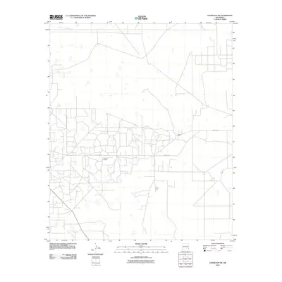
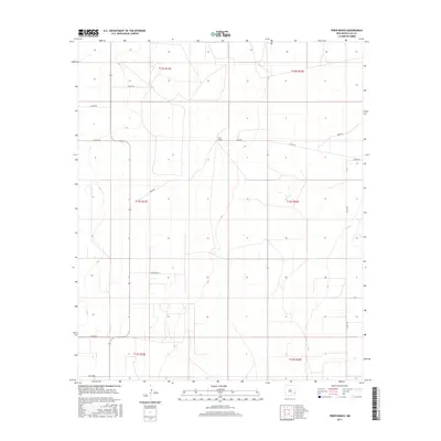
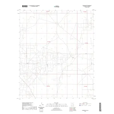
2010 Buckeye
Lea County, NM
2010 Buckeye NE
Lea County, NM
2010 Buckeye NW
Lea County, NM
2010 Caprock
Lea County, NM
2010 Cooper-Good Ranch
Lea County, NM
2010 Crossroads
Lea County, NM
2010 Custer Mountain
Lea County, NM
2010 Dallas Store
Lea County, NM
2010 Dean Ranch
Lea County, NM
2010 Dog Lake
Lea County, NM
2010 East Lake
Lea County, NM
2010 Flying M Ranch
Lea County, NM
2010 Fort Ranch
Lea County, NM
2010 Frier Ranch
Lea County, NM
2010 Gladiola
Lea County, NM
2010 Grama Ridge
Lea County, NM
2010 Hillburn City
Lea County, NM
2010 Hillburn City SW
Lea County, NM
2010 Hobbs East
Lea County, NM

2010 Hobbs SW
Lea County, NM
2010 Hobbs West
Lea County, NM
2010 Humble City
Lea County, NM
2010 Humble City NW
Lea County, NM
2010 Ironhouse Draw
Lea County, NM
2010 Ironhouse Well
Lea County, NM
2010 Jal NW
Lea County, NM
2010 Javelina Basin
Lea County, NM
2010 Johnson Ranch
Lea County, NM
2010 Laguna Gatuna
Lea County, NM
2010 Laguna Gatuna NW
Lea County, NM
2010 Lane Salt Lake
Lea County, NM
2010 Lea
Lea County, NM
2010 Lovington NW
Lea County, NM
2010 Lovington SE
Lea County, NM
2010 Lovington SW
Lea County, NM
2010 Milnesand SW
Lea County, NM
2010 Monument North
Lea County, NM
2010 Monument South
Lea County, NM
2010 Monument SW
Lea County, NM
2010 Oil Center
Lea County, NM
2010 Paduca Breaks East
Lea County, NM
2010 Paduca Breaks NW
Lea County, NM
2010 Paduca Breaks West
Lea County, NM
2010 Prairieview
Lea County, NM
2010 Prairieview NE
Lea County, NM
2010 Prairieview NW
Lea County, NM
2010 Ranger Lake
Lea County, NM
2010 Rattlesnake Canyon
Lea County, NM
2010 San Simon Ranch
Lea County, NM
2010 San Simon Sink
Lea County, NM
2010 Simanola Valley
Lea County, NM
2010 Soldier Hill
Lea County, NM
2010 Tatum North
Lea County, NM
2010 Tatum South
Lea County, NM
2010 The Divide
Lea County, NM
2010 Tip Top Wells
Lea County, NM
2010 Walking Cane Ranch
Lea County, NM
2010 Woodley Flat
Lea County, NM
2013 Alston Ranch
Lea County, NM
2013 Andrews Place
Lea County, NM
2013 Bell Lake
Lea County, NM
2013 Bledsoe SW
Lea County, NM
2013 Bootleg Ridge
Lea County, NM
2013 Bronco NE
Lea County, NM
2013 Buckeye
Lea County, NM
2013 Buckeye NE
Lea County, NM
2013 Buckeye NW
Lea County, NM
2013 Caprock
Lea County, NM
2013 Cooper-Good Ranch
Lea County, NM
2013 Crossroads
Lea County, NM
2013 Custer Mountain
Lea County, NM
2013 Dallas Store
Lea County, NM
2013 Dean Ranch
Lea County, NM
2013 Dog Lake
Lea County, NM
2013 East Lake
Lea County, NM
2013 Flying M Ranch
Lea County, NM
2013 Fort Ranch
Lea County, NM
2013 Frier Ranch
Lea County, NM
2013 Gladiola
Lea County, NM
2013 Grama Ridge
Lea County, NM
2013 Hillburn City
Lea County, NM
2013 Hillburn City SW
Lea County, NM
2013 Hobbs East
Lea County, NM
2013 Hobbs SW
Lea County, NM
2013 Hobbs West
Lea County, NM
2013 Humble City
Lea County, NM
2013 Humble City NW
Lea County, NM
2013 Ironhouse Draw
Lea County, NM
2013 Ironhouse Well
Lea County, NM
2013 Jal NW
Lea County, NM
2013 Javelina Basin
Lea County, NM
2013 Johnson Ranch
Lea County, NM
2013 Laguna Gatuna
Lea County, NM
2013 Laguna Gatuna NW
Lea County, NM
2013 Lane Salt Lake
Lea County, NM
2013 Lea
Lea County, NM
2013 Lovington NW
Lea County, NM
2013 Lovington SE
Lea County, NM
2013 Lovington SW
Lea County, NM
2013 Milnesand SW
Lea County, NM
2013 Monument North
Lea County, NM
2013 Monument South
Lea County, NM
2013 Monument SW
Lea County, NM
2013 Oil Center
Lea County, NM
2013 Paduca Breaks East
Lea County, NM
2013 Paduca Breaks NW
Lea County, NM
2013 Paduca Breaks West
Lea County, NM
2013 Prairieview
Lea County, NM
2013 Prairieview NE
Lea County, NM
2013 Prairieview NW
Lea County, NM
2013 Ranger Lake
Lea County, NM
2013 Rattlesnake Canyon
Lea County, NM
2013 San Simon Ranch
Lea County, NM
2013 San Simon Sink
Lea County, NM
2013 Simanola Valley
Lea County, NM
2013 Soldier Hill
Lea County, NM
2013 Tatum North
Lea County, NM
2013 Tatum South
Lea County, NM
2013 The Divide
Lea County, NM
2013 Tip Top Wells
Lea County, NM
2013 Walking Cane Ranch
Lea County, NM
2013 Woodley Flat
Lea County, NM
2017 Alston Ranch
Lea County, NM
2017 Andrews Place
Lea County, NM
2017 Bell Lake
Lea County, NM
2017 Bledsoe SW
Lea County, NM
2017 Bootleg Ridge
Lea County, NM
2017 Bronco NE
Lea County, NM
2017 Buckeye
Lea County, NM
2017 Buckeye NE
Lea County, NM
2017 Buckeye NW
Lea County, NM
2017 Caprock
Lea County, NM
2017 Cooper-Good Ranch
Lea County, NM
2017 Crossroads
Lea County, NM
2017 Custer Mountain
Lea County, NM
2017 Dallas Store
Lea County, NM
2017 Dean Ranch
Lea County, NM
2017 Dog Lake
Lea County, NM
2017 East Lake
Lea County, NM
2017 Flying M Ranch
Lea County, NM
2017 Fort Ranch
Lea County, NM
2017 Frier Ranch
Lea County, NM
2017 Gladiola
Lea County, NM
2017 Grama Ridge
Lea County, NM
2017 Hillburn City
Lea County, NM
2017 Hillburn City SW
Lea County, NM
2017 Hobbs East
Lea County, NM
2017 Hobbs SW
Lea County, NM
2017 Hobbs West
Lea County, NM
2017 Humble City
Lea County, NM
2017 Humble City NW
Lea County, NM
2017 Ironhouse Draw
Lea County, NM
2017 Ironhouse Well
Lea County, NM
2017 Jal NW
Lea County, NM
2017 Javelina Basin
Lea County, NM
2017 Johnson Ranch
Lea County, NM
2017 Laguna Gatuna
Lea County, NM
2017 Laguna Gatuna NW
Lea County, NM
2017 Lane Salt Lake
Lea County, NM
2017 Lea
Lea County, NM
2017 Lovington NW
Lea County, NM
2017 Lovington SE
Lea County, NM
2017 Lovington SW
Lea County, NM
2017 Milnesand SW
Lea County, NM
2017 Monument North
Lea County, NM
2017 Monument South
Lea County, NM
2017 Monument SW
Lea County, NM

2017 Oil Center
Lea County, NM
2017 Paduca Breaks East
Lea County, NM
2017 Paduca Breaks NW
Lea County, NM
2017 Paduca Breaks West
Lea County, NM
2017 Prairieview
Lea County, NM
2017 Prairieview NE
Lea County, NM
2017 Prairieview NW
Lea County, NM
2017 Ranger Lake
Lea County, NM
2017 Rattlesnake Canyon
Lea County, NM
2017 San Simon Ranch
Lea County, NM
2017 San Simon Sink
Lea County, NM
2017 Simanola Valley
Lea County, NM
2017 Soldier Hill
Lea County, NM
2017 Tatum North
Lea County, NM
2017 Tatum South
Lea County, NM
2017 The Divide
Lea County, NM
2017 Tip Top Wells
Lea County, NM
2017 Walking Cane Ranch
Lea County, NM
2017 Woodley Flat
Lea County, NM
2020 Alston Ranch
Lea County, NM
2020 Andrews Place
Lea County, NM
2020 Bell Lake
Lea County, NM
2020 Bledsoe SW
Lea County, NM
2020 Bootleg Ridge
Lea County, NM
2020 Bronco NE
Lea County, NM
2020 Buckeye
Lea County, NM
2020 Buckeye NE
Lea County, NM
2020 Buckeye NW
Lea County, NM
2020 Caprock
Lea County, NM
2020 Cooper-Good Ranch
Lea County, NM
2020 Crossroads
Lea County, NM
2020 Custer Mountain
Lea County, NM
2020 Dallas Store
Lea County, NM
2020 Dean Ranch
Lea County, NM
2020 Dog Lake
Lea County, NM
2020 East Lake
Lea County, NM
2020 Flying M Ranch
Lea County, NM
2020 Fort Ranch
Lea County, NM
2020 Frier Ranch
Lea County, NM
2020 Gladiola
Lea County, NM
2020 Grama Ridge
Lea County, NM
2020 Hillburn City
Lea County, NM
2020 Hillburn City SW
Lea County, NM
2020 Hobbs East
Lea County, NM
2020 Hobbs SW
Lea County, NM
2020 Hobbs West
Lea County, NM
2020 Humble City
Lea County, NM
2020 Humble City NW
Lea County, NM
2020 Ironhouse Draw
Lea County, NM
2020 Ironhouse Well
Lea County, NM
2020 Jal NW
Lea County, NM
2020 Javelina Basin
Lea County, NM
2020 Johnson Ranch
Lea County, NM
2020 Laguna Gatuna
Lea County, NM
2020 Laguna Gatuna NW
Lea County, NM
2020 Lane Salt Lake
Lea County, NM
2020 Lea
Lea County, NM
2020 Lovington NW
Lea County, NM
2020 Lovington SE
Lea County, NM
2020 Lovington SW
Lea County, NM
2020 Milnesand SW
Lea County, NM
2020 Monument North
Lea County, NM
2020 Monument South
Lea County, NM
2020 Monument SW
Lea County, NM
2020 Oil Center
Lea County, NM
2020 Paduca Breaks East
Lea County, NM
2020 Paduca Breaks NW
Lea County, NM
2020 Paduca Breaks West
Lea County, NM
2020 Prairieview
Lea County, NM
2020 Prairieview NE
Lea County, NM
2020 Prairieview NW
Lea County, NM
2020 Ranger Lake
Lea County, NM
2020 Rattlesnake Canyon
Lea County, NM
2020 San Simon Ranch
Lea County, NM
2020 San Simon Sink
Lea County, NM
2020 Simanola Valley
Lea County, NM
2020 Soldier Hill
Lea County, NM
2020 Tatum North
Lea County, NM
2020 Tatum South
Lea County, NM
2020 The Divide
Lea County, NM
2020 Tip Top Wells
Lea County, NM
2020 Walking Cane Ranch
Lea County, NM
2020 Woodley Flat
Lea County, NM
2023 Alston Ranch
Lea County, NM
2023 Andrews Place
Lea County, NM
2023 Bell Lake
Lea County, NM
2023 Bledsoe SW
Lea County, NM
2023 Bootleg Ridge
Lea County, NM
2023 Bronco NE
Lea County, NM
2023 Buckeye
Lea County, NM
2023 Buckeye NE
Lea County, NM
2023 Buckeye NW
Lea County, NM
2023 Caprock
Lea County, NM
2023 Cooper-Good Ranch
Lea County, NM
2023 Crossroads
Lea County, NM
2023 Custer Mountain
Lea County, NM
2023 Dallas Store
Lea County, NM
2023 Dean Ranch
Lea County, NM
2023 Dog Lake
Lea County, NM

2023 East Lake
Lea County, NM
2023 Flying M Ranch
Lea County, NM
2023 Fort Ranch
Lea County, NM
2023 Frier Ranch
Lea County, NM
2023 Gladiola
Lea County, NM
2023 Grama Ridge
Lea County, NM
2023 Hillburn City
Lea County, NM
2023 Hillburn City SW
Lea County, NM
2023 Hobbs East
Lea County, NM
2023 Hobbs SW
Lea County, NM
2023 Hobbs West
Lea County, NM
2023 Humble City
Lea County, NM
2023 Humble City NW
Lea County, NM
2023 Ironhouse Draw
Lea County, NM
2023 Ironhouse Well
Lea County, NM
2023 Jal NW
Lea County, NM
2023 Javelina Basin
Lea County, NM
2023 Johnson Ranch
Lea County, NM
2023 Laguna Gatuna
Lea County, NM
2023 Laguna Gatuna NW
Lea County, NM
2023 Lane Salt Lake
Lea County, NM
2023 Lea
Lea County, NM
2023 Lovington NW
Lea County, NM
2023 Lovington SE
Lea County, NM
2023 Lovington SW
Lea County, NM
2023 Milnesand SW
Lea County, NM
2023 Monument North
Lea County, NM
2023 Monument South
Lea County, NM
2023 Monument SW
Lea County, NM
2023 Oil Center
Lea County, NM
2023 Paduca Breaks East
Lea County, NM
2023 Paduca Breaks NW
Lea County, NM
2023 Paduca Breaks West
Lea County, NM
2023 Prairieview
Lea County, NM
2023 Prairieview NE
Lea County, NM
2023 Prairieview NW
Lea County, NM
2023 Ranger Lake
Lea County, NM
2023 Rattlesnake Canyon
Lea County, NM
2023 San Simon Ranch
Lea County, NM
2023 San Simon Sink
Lea County, NM
2023 Simanola Valley
Lea County, NM
2023 Soldier Hill
Lea County, NM
2023 Tatum North
Lea County, NM
2023 Tatum South
Lea County, NM
2023 The Divide
Lea County, NM
2023 Tip Top Wells
Lea County, NM
2023 Walking Cane Ranch
Lea County, NM

2023 Woodley Flat
Lea County, NM