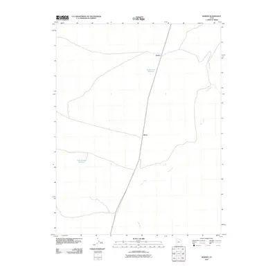
2010 Map of Borden
USGS Topo · Published 2010About this map
Beaver River winds through the eastern edge of this Millard County landscape, a vital water source in a region defined by sparse settlements and infrastructure for arid-land water management. The small rail-aligned settlements of Borden and Bloom serve as the primary human focal points, situated along a prominent north-south transportation corridor that transects the desert terrain. This 2010 survey illustrates the region's reliance on engineered hydrology, featuring sites like the Borden Basin Reservoir and Halls Double Reservoir. These features suggest a landscape optimized for seasonal ranching or resource management, where the presence of water determines the footprint of human activity. The map reveals the relationship between the natural course of the river and the rigid, straight-line efficiency of the modern highway and rail network.
Find a feature on this map
5 named features on this map. Tap any name to fly to it.
Don’t see what you’re looking for? This feature index may not catch every label — zoom into the map to look around manually.
Map Details
Editions of this 2010 Borden Map
This is the sole edition of this map. No revisions or reprints were ever made.
Other maps of this area

1885 · Beaver
USGS Topo · 1:250,000

1885 · Sevier Desert
USGS Topo · 1:250,000

1953 · Richfield
USGS Topo · 1:250,000

1953 · Delta
USGS Topo · 1:250,000

1958 · Richfield
USGS Topo · 1:250,000

1958 · Delta
USGS Topo · 1:250,000

1962 · Delta
USGS Topo · 1:250,000

1962 · Tabernacle Hill
USGS Topo · 1:62,500

1971 · Red Pass
USGS Topo · 1:24,000

1971 · Neels
USGS Topo · 1:24,000