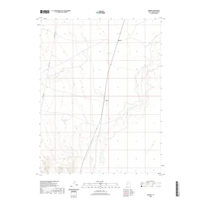
2020 Map of Borden
USGS Topo · Published 2020About this map
The Beaver River meanders through the eastern portion of this Millard County landscape, defining the local hydrology alongside several significant water storage features. Small settlements like Borden and Bloom are situated along the primary transportation corridor, which bisects the quadrangle from north to south. The presence of Borden Basin Reservoir and Halls Double Reservoir suggests a concentrated effort to manage water resources in this arid region, likely supporting local ranching or agricultural activities. To the west, the infrastructure is marked by the utilitarian path of Power Line Up Rd, which cuts across the undulating terrain. This map provides a look at the essential infrastructure and sparse settlement patterns that characterize this part of central Utah.
Find a feature on this map
6 named features on this map. Tap any name to fly to it.
Don’t see what you’re looking for? This feature index may not catch every label — zoom into the map to look around manually.
Map Details
Editions of this 2020 Borden Map
This is the sole edition of this map. No revisions or reprints were ever made.
Other maps of this area

1885 · Beaver
USGS Topo · 1:250,000

1885 · Sevier Desert
USGS Topo · 1:250,000

1953 · Richfield
USGS Topo · 1:250,000

1953 · Delta
USGS Topo · 1:250,000

1958 · Richfield
USGS Topo · 1:250,000

1958 · Delta
USGS Topo · 1:250,000

1962 · Delta
USGS Topo · 1:250,000

1962 · Tabernacle Hill
USGS Topo · 1:62,500

1971 · Red Pass
USGS Topo · 1:24,000

1971 · Neels
USGS Topo · 1:24,000