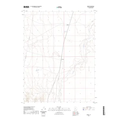
2023 Map of Borden
USGS Topo · Published 2023About this map
Beaver River meanders through this section of Millard County, shaping a landscape defined by water management and transit corridors. The small settlements of Borden and Bloom are positioned along the primary north-south thoroughfare, serving as focal points in an otherwise open terrain. To the east, the distinct elevation of Sand Ridge rises above the river valley, while the presence of Borden Basin Reservoir and Hells Double Reservoir indicates the critical role of water storage in this arid environment. The map also traces the path of Power Line Up Rd as it cuts across the western portion of the quadrangle, reflecting the infrastructure necessary to connect these remote locales. This 2023 survey provides a clear view of the modern rural layout, where the historical reliance on the river persists alongside contemporary utility and transport networks.
Find a feature on this map
7 named features on this map. Tap any name to fly to it.
Don’t see what you’re looking for? This feature index may not catch every label — zoom into the map to look around manually.
Map Details
Editions of this 2023 Borden Map
This is the sole edition of this map. No revisions or reprints were ever made.
Other maps of this area

1885 · Beaver
USGS Topo · 1:250,000

1885 · Sevier Desert
USGS Topo · 1:250,000

1953 · Richfield
USGS Topo · 1:250,000

1953 · Delta
USGS Topo · 1:250,000

1958 · Richfield
USGS Topo · 1:250,000

1958 · Delta
USGS Topo · 1:250,000

1962 · Delta
USGS Topo · 1:250,000

1962 · Tabernacle Hill
USGS Topo · 1:62,500

1971 · Red Pass
USGS Topo · 1:24,000

1971 · Neels
USGS Topo · 1:24,000