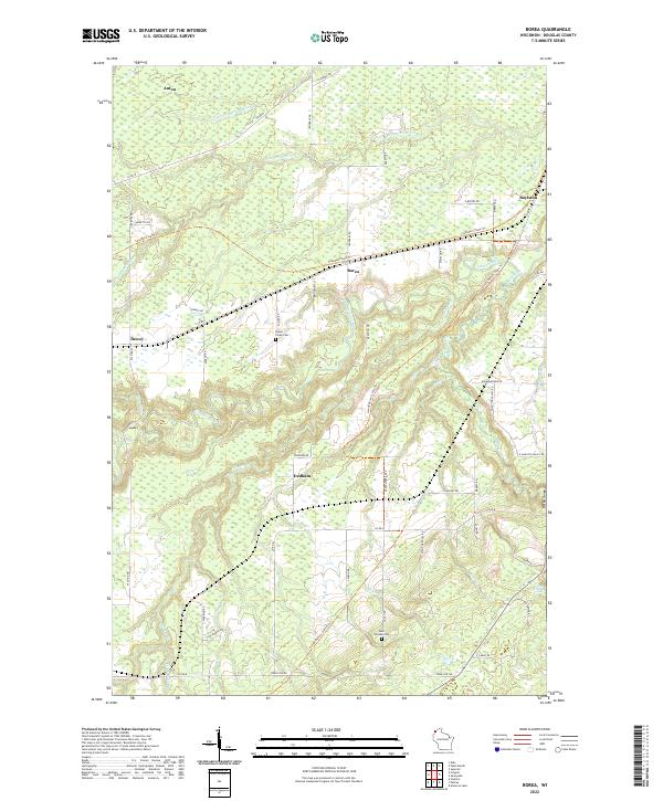
2022 Map of Borea
USGS Topo · Published 2022About this map
The Nemadji River and its various tributaries wind through the rural landscape of Douglas County in this 2022 survey. This area of northern Wisconsin features several established settlements, including Borea, Anton, Boylston, Dewey, and Dedham. Local history researchers can pinpoint the locations of Poplar Creek Cemetery and Saint William Cemetery, while outdoor enthusiasts can trace the paths of the Saunders State Trail and the Gandy Dancer State Trail. The map captures the natural geography of the region, specifically Rocky Gorge and the notable Little Manitou Falls. Extensive road networks like Pattison Tower Road and County Road B connect these communities across the township lines of t47n r14w and t48n r15w, documenting the modern infrastructure and drainage patterns within this primarily forested region.
Find a feature on this map
60 named features on this map. Tap any name to fly to it.
Don’t see what you’re looking for? This feature index may not catch every label — zoom into the map to look around manually.
Map Details
Editions of this 2022 Borea Map
This is the sole edition of this map. No revisions or reprints were ever made.
Other maps of this area

1915 · Superior
USGS Topo · 1:48,000

1917 · Superior
USGS Topo · 1:62,500

1949 · Holyoke
USGS Topo · 1:48,000

1949 · Patzau
USGS Topo · 1:48,000

1953 · Duluth
USGS Topo · 1:250,000

1954 · West Duluth
USGS Topo · 1:24,000

1954 · Borea
USGS Topo · 1:24,000

1954 · Foxboro
USGS Topo · 1:24,000

1954 · Sunnyside
USGS Topo · 1:24,000
1954 · Superior
USGS Topo · 1:24,000