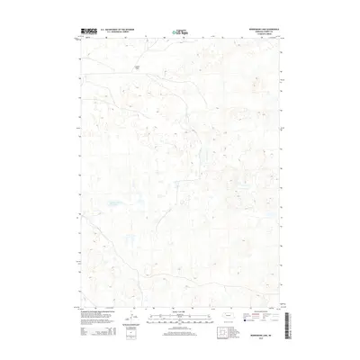
2014 Map of Bornemann Lake
USGS Topo · Published 2014About this map
Bornemann Lake lies at the center of this terrain in Cherry County, where the topography is defined by the unique hydrology of the Nebraska Sandhills. North of the lake, the Lavaca Flats represent a distinct change in elevation, providing a rare stretch of level ground in a landscape otherwise dominated by intricate contour lines. This 2014 survey by the U.S. Geological Survey shows a sparsely populated region where natural landforms and water bodies remain the primary landmarks, illustrating the enduring isolation and specific environmental character of this portion of the Great Plains.
Find a feature on this map
2 named features on this map. Tap any name to fly to it.
Don’t see what you’re looking for? This feature index may not catch every label — zoom into the map to look around manually.
Map Details
Editions of this 2014 Bornemann Lake Map
This is the sole edition of this map. No revisions or reprints were ever made.
Other maps of this area

1950 · Irwin
USGS Topo · 1:62,500

1951 · Irwin
USGS Topo · 1:62,500

1951 · Gypsy Valley
USGS Topo · 1:62,500

1951 · Merriman
USGS Topo · 1:62,500

1951 · Merriman 4
USGS Topo · 1:62,500

1957 · Valentine
USGS Topo · 1:250,000

1959 · Valentine
USGS Topo · 1:250,000

1985 · Cody
USGS Topo · 1:100,000
1990 · Wild Mare Lake SW
USGS Topo · 1:24,000
1990 · North Valley
USGS Topo · 1:24,000