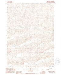
1990 Map of North Valley
USGS Topo · Published 1990About this map
North Valley and the Snake River define this stretch of Cherry County, Nebraska, where the landscape is organized around scattered ranching operations and natural drainages. This late-twentieth-century landscape is characterized by its isolation and the naming of specific properties, such as the Sasse-Vinton Ranch and multiple holdings belonging to the Kime family, including the Steve Kime Ranch and Archie Kime Ranch. The presence of the North Valley Sch suggests a focal point for the rural community inhabiting this expansive terrain. To the south, the map transitions into the Tennessee Valley, with Willow Creek and Clifford Creek providing vital water sources for the cattle-driven economy of the Sandhills region.
Find a feature on this map
10 named features on this map. Tap any name to fly to it.
Don’t see what you’re looking for? This feature index may not catch every label — zoom into the map to look around manually.
Map Details
Editions of this 1990 North Valley Map
This is the sole edition of this map. No revisions or reprints were ever made.
Other maps of this area

1949 · Steverson Lake
USGS Topo · 1:62,500

1949 · Turpin Lake
USGS Topo · 1:62,500

1951 · Steverson Lake
USGS Topo · 1:62,500

1951 · Gypsy Valley
USGS Topo · 1:62,500

1951 · Turpin Lake
USGS Topo · 1:62,500

1951 · Merriman 4
USGS Topo · 1:62,500

1957 · Valentine
USGS Topo · 1:250,000

1959 · Valentine
USGS Topo · 1:250,000

1985 · Mullen
USGS Topo · 1:100,000

1985 · Cody
USGS Topo · 1:100,000