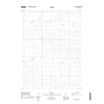
2017 Map of Bornemann Lake
USGS Topo · Published 2017About this map
Bornemann Lake anchors this portion of the Nebraska Sandhills, a landscape defined by its distinctive dune formations and scattered wetlands. The area is characterized by a sparse network of water bodies and the broad expanse of Lavaca Flats in the north. The survey reflects the fundamental Public Land Survey System structure of the region, specifically portions of t31n r39w and t32n r38w, showing how the land was partitioned for grazing and ranching. This 2017 data provides a clear record of the hydrography and topography in a part of Cherry County where natural water features are critical to the environment and the local economy.
Find a feature on this map
6 named features on this map. Tap any name to fly to it.
Don’t see what you’re looking for? This feature index may not catch every label — zoom into the map to look around manually.
Map Details
Editions of this 2017 Bornemann Lake Map
This is the sole edition of this map. No revisions or reprints were ever made.
Other maps of this area

1950 · Irwin
USGS Topo · 1:62,500

1951 · Irwin
USGS Topo · 1:62,500

1951 · Gypsy Valley
USGS Topo · 1:62,500

1951 · Merriman
USGS Topo · 1:62,500

1951 · Merriman 4
USGS Topo · 1:62,500

1957 · Valentine
USGS Topo · 1:250,000

1959 · Valentine
USGS Topo · 1:250,000

1985 · Cody
USGS Topo · 1:100,000
1990 · Wild Mare Lake SW
USGS Topo · 1:24,000
1990 · North Valley
USGS Topo · 1:24,000