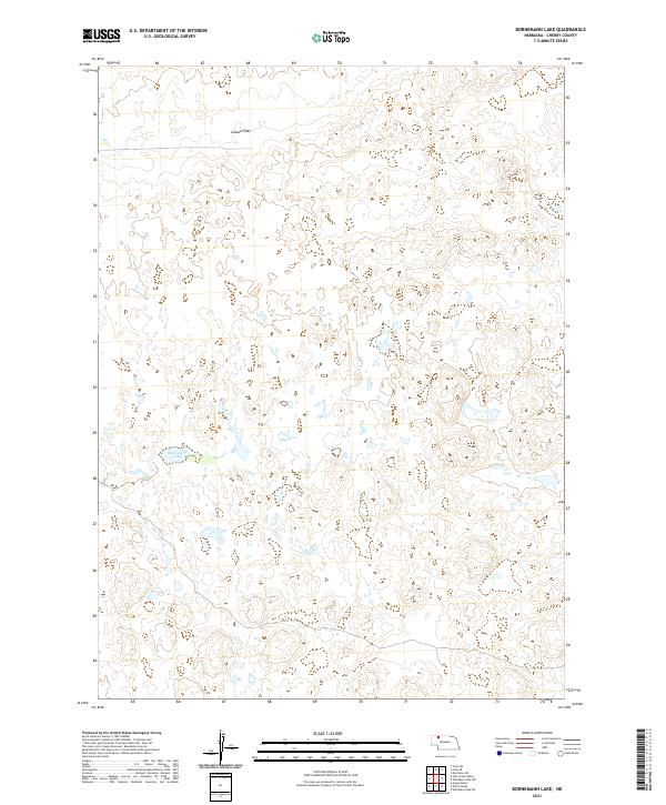
2021 Map of Bornemann Lake
USGS Topo · Published 2021About this map
Bornemann Lake lies at the heart of this landscape in Cherry County, Nebraska, a region defined by the distinct topography of the Sandhills. The area exhibits a high density of small, unnamed wetlands and ponds scattered throughout the terrain, reflecting the complex hydrology of the High Plains. Lavaca Flats occupies the northern portion of the quadrangle, illustrating the subtle variations in elevation that characterize the local basin-and-range style morphology. This 2021 survey documents the land divisions of t32n r39w, t32n r38w, t31n r39w, and t31n r38w, providing a clear record of the Public Land Survey System in an area primarily shaped by natural water features and cattle ranching history. The absence of primary roads or established towns underscores the isolation of this corner of the Nebraska interior.
Find a feature on this map
6 named features on this map. Tap any name to fly to it.
Don’t see what you’re looking for? This feature index may not catch every label — zoom into the map to look around manually.
Map Details
Editions of this 2021 Bornemann Lake Map
This is the sole edition of this map. No revisions or reprints were ever made.
Other maps of this area

1950 · Irwin
USGS Topo · 1:62,500

1951 · Irwin
USGS Topo · 1:62,500

1951 · Gypsy Valley
USGS Topo · 1:62,500

1951 · Merriman
USGS Topo · 1:62,500

1951 · Merriman 4
USGS Topo · 1:62,500

1957 · Valentine
USGS Topo · 1:250,000

1959 · Valentine
USGS Topo · 1:250,000

1985 · Cody
USGS Topo · 1:100,000
1990 · Wild Mare Lake SW
USGS Topo · 1:24,000
1990 · North Valley
USGS Topo · 1:24,000