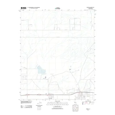
2012 Map of Boron
USGS Topo · Published 2012About this map
Boron sits at the southern edge of this Mojave Desert landscape, anchored by a grid of residential streets like Roberts Ave and Jerome ST near the local Po. The region's industrial and transportation history is visible in the network of arterial roads, most notably 20 Mule Team Rd, which references the historical mining transport of the area. Just west of the main settlement, Desert Lake and the smaller community of Baker reside near the Borax Airport, reflecting the specialized aviation and infrastructure needs of this arid environment. To the north, the terrain transitions into a more open desert expanse marked by an extensive grid of planned but largely undeveloped thoroughfares such as Sequoia Blvd and Rosewood Blvd, while the Watershed Reservoir provides a critical point of water management in the dry basin.
Find a feature on this map
49 named features on this map. Tap any name to fly to it.
Don’t see what you’re looking for? This feature index may not catch every label — zoom into the map to look around manually.
Map Details
Editions of this 2012 Boron Map
This is the sole edition of this map. No revisions or reprints were ever made.
Other maps of this area

1915 · Searles Lake
USGS Topo · 1:250,000

1937 · Kramer
USGS Topo · 1:48,000

1937 · Rogers Lake
USGS Topo · 1:48,000

1942 · Kramer
USGS Topo · 1:62,500

1942 · Rogers Lake
USGS Topo · 1:62,500

1943 · Castle Butte
USGS Topo · 1:62,500

1947 · Castle Butte
USGS Topo · 1:50,000

1947 · Kramer
USGS Topo · 1:24,000

1947 · Johannesburg SE
USGS Topo · 1:25,000

1947 · Rich
USGS Topo · 1:24,000