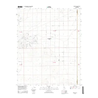
2015 Map of Boron NW
USGS Topo · Published 2015About this map
California City sprawl across the arid expanses of the Mojave Desert in this 2015 topographic record, illustrating the ambitious grid of residential streets laid out in eastern Kern County. The map details an extensive network of named roads including Buena Ventura Dr, Honeymoon Ln, and Columbia Rd, many of which represent the city's unique history as a master-planned community. Located near the Kern Co and San Bernardino Co boundary, the landscape is defined by its transition from organized suburban planning to the open desert. While many streets like Bucknell Rd and Sierra Vista Dr are clearly delineated, the vast interior sections of the quadrangle remain largely undeveloped, highlighting the contrast between 20th-century urban aspirations and the realities of the desert environment.
Find a feature on this map
62 named features on this map. Tap any name to fly to it.
Don’t see what you’re looking for? This feature index may not catch every label — zoom into the map to look around manually.
Map Details
Editions of this 2015 Boron NW Map
This is the sole edition of this map. No revisions or reprints were ever made.
Other maps of this area

1903 · Randsburg
USGS Topo · 1:62,500

1911 · Randsburg
USGS Topo · 1:62,500

1912 · Randsburg
USGS Topo · 1:62,500

1915 · Searles Lake
USGS Topo · 1:250,000

1943 · Saltdale
USGS Topo · 1:62,500

1943 · Castle Butte
USGS Topo · 1:62,500

1947 · Castle Butte
USGS Topo · 1:50,000

1947 · Johannesburg SE
USGS Topo · 1:25,000
1947 · Castle Butte SE
USGS Topo · 1:24,000

1947 · Johannesburg SW
USGS Topo · 1:24,000