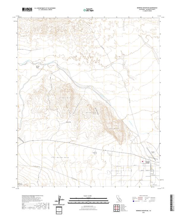
2021 Map of Borrego Mountain
USGS Topo · Published 2021About this map
Ocotillo Wells serves as a small hub of activity in this desert landscape, situated at the intersection of several local routes near the southeastern edge of the survey. The terrain is defined by the prominent rises of Borrego Mtn, which is flanked by the distinct elevations of West Butte and East Butte. These landmarks overlook the expansive Borrego Valley and Lower Borrego Valley, regions characterized by seasonal watercourses like San Felipe Cr and the Borrego Sink Wash. The presence of the Ocotillo Airport and the network of roads such as Old Kane Springs Rd and Borrego Valley Rd illustrate the area's development for both recreational and local transportation. The southern boundary is framed by the rising slopes of the Vallecito Mountains, providing a geological anchor to the lower desert floor.
Find a feature on this map
28 named features on this map. Tap any name to fly to it.
Don’t see what you’re looking for? This feature index may not catch every label — zoom into the map to look around manually.
Map Details
Editions of this 2021 Borrego Mountain Map
This is the sole edition of this map. No revisions or reprints were ever made.
Other maps of this area

1904 · Indio
USGS Topo · 1:125,000

1931 · Vallecito
USGS Topo · 1:125,000

1939 · Borrego
USGS Topo · 1:62,500

1941 · Clark Lake
USGS Topo · 1:62,500

1942 · Barrel Spring
USGS Topo · 1:62,500

1942 · Agua Dulce
USGS Topo · 1:62,500

1942 · Clark Lake
USGS Topo · 1:62,500

1942 · Borego
USGS Topo · 1:62,500

1943 · Vallecito
USGS Topo · 1:125,000

1944 · Agua Dulce
USGS Topo · 1:62,500