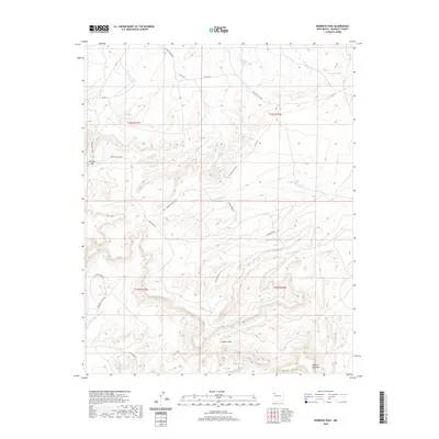
2020 Map of Borrego Pass
USGS Topo · Published 2020About this map
Borrego Pass serves as a focal point for this high-desert landscape in the Eastern Navajo Agency, where the terrain is defined by deep drainages and rising tablelands. The southern portion of the sheet is dominated by the broad Mesa de Jaramillo and the winding course of Cañon Largo. This region’s hydraulic history is visible through a network of seasonal watercourses like Cañada Marcelina, Cañada Milpitas, and Cañada de Saladeta Canyon, as well as the spring at Ojo del Chopo. Transportation through this isolated terrain relies on a system of Indian Service Routes and local roads, including Crow Mesa Rd and Star Pond Rd. The map illustrates a complex topography of mesas and arroyos typical of McKinley County, providing a clear view of the land use and natural water features used by local inhabitants in the early 21st century.
Find a feature on this map
23 named features on this map. Tap any name to fly to it.
Don’t see what you’re looking for? This feature index may not catch every label — zoom into the map to look around manually.
Map Details
Editions of this 2020 Borrego Pass Map
This is the sole edition of this map. No revisions or reprints were ever made.
Other maps of this area

1883 · Mt. Taylor
USGS Topo · 1:250,000

1886 · Wingate
USGS Topo · 1:250,000

1886 · Mt. Taylor
USGS Topo · 1:250,000

1892 · Wingate
USGS Topo · 1:250,000

1892 · Mt. Taylor
USGS Topo · 1:250,000

1899 · Mt. Taylor
USGS Topo · 1:250,000

1954 · Gallup
USGS Topo · 1:250,000

1957 · Ambrosia Lake
USGS Topo · 1:24,000

1957 · Goat Mountain
USGS Topo · 1:24,000

1958 · Gallup
USGS Topo · 1:250,000