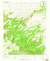
1963 Map of Borrego Pass
USGS Topo · Published 1965About this map
Continental Divide winds through this high-altitude landscape in McKinley County, marking a fundamental geological boundary between the region's vast drainages. In this mid-century survey, the high plateaus and deep arroyos define the character of the terrain, with Mesa de Jaramillo dominating the southern reaches. The settlement of Borrego Pass serves as a primary local landmark, situated amidst a network of unimproved dirt roads that navigate the complex topography. Evidence of ranching and remote habitation is present at Albers Ranch near the spring at Ojo del Chopo. The map meticulously details the canyon systems that carve through the mesa country, including the prominent Cañon Largo and the winding Cañada Marcelina, providing a clear record of the area's physical geography and limited human footprint during the early 1960s.
Find a feature on this map
12 named features on this map. Tap any name to fly to it.
Don’t see what you’re looking for? This feature index may not catch every label — zoom into the map to look around manually.
Map Details
Editions of this 1963 Borrego Pass Map
This is the sole edition of this map. No revisions or reprints were ever made.
Other maps of this area

1883 · Mt. Taylor
USGS Topo · 1:250,000

1886 · Wingate
USGS Topo · 1:250,000

1886 · Mt. Taylor
USGS Topo · 1:250,000

1892 · Wingate
USGS Topo · 1:250,000

1892 · Mt. Taylor
USGS Topo · 1:250,000

1899 · Mt. Taylor
USGS Topo · 1:250,000

1954 · Gallup
USGS Topo · 1:250,000

1957 · Ambrosia Lake
USGS Topo · 1:24,000

1957 · Goat Mountain
USGS Topo · 1:24,000

1958 · Gallup
USGS Topo · 1:250,000