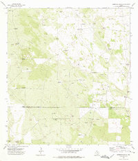
1972 Map of Borregos Ranch
USGS Topo · Published 1975About this map
The Jim Hogg and Starr County line bisects this South Texas landscape, defined by a sparse ranching economy in the early 1970s. The area is characterized by an extensive network of named windmills, which serve as the primary landmarks across the brushland. Distinctive sites such as Borregos Ranch and Rancho Viejo anchor the survey, while numerous Oil Wells and a scattering of Gravel Pits indicate the region's mineral interests. The presence of isolated Cemeteries and family-named structures like Santa Barbara Windmill and Sufrimiento Windmill provide specific points of interest for genealogists tracing local landholdings. This survey also records various infrastructure elements of the era, including multiple pipelines and a prominent Radio Tower near the eastern boundary.
Find a feature on this map
31 named features on this map. Tap any name to fly to it.
Don’t see what you’re looking for? This feature index may not catch every label — zoom into the map to look around manually.
Map Details
Editions of this 1972 Borregos Ranch Map
2 editions found
Other maps of this area

1938 · El Sauz
USGS Topo · 1:62,500

1938 · Agua Nueva
USGS Topo · 1:62,500

1938 · Sal Colorada
USGS Topo · 1:62,500

1938 · Cuevitas
USGS Topo · 1:62,500

1949 · Mc Allen
USGS Topo · 1:250,000

1954 · McAllen
USGS Topo · 1:250,000

1957 · Mc Allen
USGS Topo · 1:250,000

1962 · McAllen
USGS Topo · 1:250,000

1972 · Cuevitas
USGS Topo · 1:24,000
1972 · Viboras
USGS Topo · 1:24,000