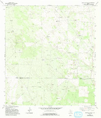
1972 Map of Borregos Ranch
USGS Topo · Published 1993About this map
The ranching country of South Texas is captured here across the border of Jim Hogg and Starr Counties. This landscape is defined by its reliance on underground water sources, evidenced by an extensive network of named windmills such as Los Corrales Windmill, Sacatones Windmill, and Santa Barbara Windmill. These points of water, along with various tanks like San Jose Tank, supported the region's livestock operations during the early 1970s.
Find a feature on this map
31 named features on this map. Tap any name to fly to it.
Don’t see what you’re looking for? This feature index may not catch every label — zoom into the map to look around manually.
Map Details
Editions of this 1972 Borregos Ranch Map
2 editions found
Other maps of this area

1938 · El Sauz
USGS Topo · 1:62,500

1938 · Agua Nueva
USGS Topo · 1:62,500

1938 · Sal Colorada
USGS Topo · 1:62,500

1938 · Cuevitas
USGS Topo · 1:62,500

1949 · Mc Allen
USGS Topo · 1:250,000

1954 · McAllen
USGS Topo · 1:250,000

1957 · Mc Allen
USGS Topo · 1:250,000

1962 · McAllen
USGS Topo · 1:250,000

1972 · Cuevitas
USGS Topo · 1:24,000
1972 · Viboras
USGS Topo · 1:24,000