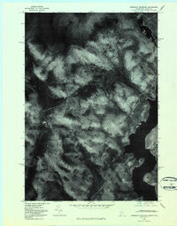
1976 Map of Bosebuck Mountain
USGS Topo · Published 1983About this map
Aziscohos Lake dominates the southeastern quadrant of this orthophotomap, its dark waters contrasting against the dense timberland of Oxford County. Recorded from aerial photography in 1976, this sheet reveals the intricate drainage patterns of the high country, where the Little Magalloway River and Dead Diamond River carve through the northern forest. The landscape is defined by significant elevations like Bosebuck Mountain and Stub Hill, serving as critical landmarks for surveying and navigation in this borderland between Maine and New Hampshire. Local waterways such as Big Brook, Meadow Brook, and Abbott Brook weave through the timber-thick slopes. This imagery provides an unvarnished look at the region's wilderness character and logging road networks before modern development altered the forest floor's appearance.
Find a feature on this map
8 named features on this map. Tap any name to fly to it.
Don’t see what you’re looking for? This feature index may not catch every label — zoom into the map to look around manually.
Map Details
Editions of this 1976 Bosebuck Mountain Map
This is the sole edition of this map. No revisions or reprints were ever made.
Other maps of this area

1927 · Second Lake
USGS Topo · 1:62,500

1930 · Errol
USGS Topo · 1:62,500

1931 · Cupsuptic
USGS Topo · 1:48,000

1932 · Second Lake
USGS Topo · 1:62,500

1934 · Cupsuptic
USGS Topo · 1:62,500

1934 · Errol
USGS Topo · 1:62,500

1935 · Cupsuptic
USGS Topo · 1:62,500

1940 · Oquossoc
USGS Topo · 1:62,500

1942 · Oquossoc
USGS Topo · 1:62,500

1949 · Jackman
USGS Topo · 1:250,000
Featured Places
- Pittsburg, NH
- Atkinson and Gilmanton Academy Grant, NH
- Lynchtown Township, ME
- Parkertown Township, ME
- Oxford County, ME