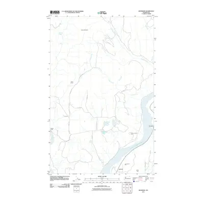
2011 Map of Bossburg
USGS Topo · Published 2011About this map
Bossburg sits along the shores of Franklin D Roosevelt Lake in this topographic study of the Upper Columbia River region. The landscape is defined by the legacy of resource extraction, clearly marked by the Young America Mine near the townsite and the Northwest Marble Mine further inland. The transition from the rugged slopes of Jumbo Mountain and Spion Kop to the water's edge illustrates the geographic challenges faced by early settlers and industrial operations in Stevens County. A network of rural routes including Hill Branch Rd, Behrens Rd, and McNitt Rd connect scattered water bodies like Ryan Lake and Buhrig Lake, reflecting the persistent small-scale development of the area. The presence of the North Gorge Campground and the flowing Kettle River at the western margin highlights the modern dual identity of the region as both a working landscape and a site for outdoor recreation.
Find a feature on this map
28 named features on this map. Tap any name to fly to it.
Don’t see what you’re looking for? This feature index may not catch every label — zoom into the map to look around manually.
Map Details
Editions of this 2011 Bossburg Map
This is the sole edition of this map. No revisions or reprints were ever made.
Other maps of this area

1929 · Colville
USGS Topo · 1:125,000

1933 · Colville
USGS Topo · 1:125,000

1936 · Marcus
USGS Topo · 1:96,000

1942 · Marcus
USGS Topo · 1:125,000

1948 · Kettle Falls
USGS Topo · 1:62,500

1948 · Orient
USGS Topo · 1:62,500

1951 · Orient
USGS Topo · 1:62,500

1951 · Kettle Falls
USGS Topo · 1:62,500

1952 · Echo Valley
USGS Topo · 1:24,000

1954 · Okanogan
USGS Topo · 1:250,000