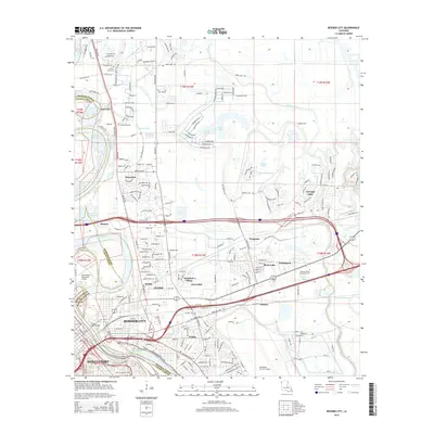
2015 Map of Bossier City
USGS Topo · Published 2015About this map
The Red River carves a deep boundary between Shreveport and Bossier City, defining the urban and industrial development of this Northwest Louisiana landscape. In the mid-2010s, the area shows a dense network of suburban growth alongside legacy industrial and military sites, such as the sprawling Barksdale Air Force Base and the Shreveport Downtown Airport. Moving north from the city centers, the terrain transitions into a complex system of bayous and lakes, including Willow Chute, Benoit Bayou, and Swan Lake, where smaller settlements like Vanceville and Brownlee are situated. Significant local landmarks such as Bossier Parish Community College and historic sites like Mount Zion Cem and Greenwood Cem offer essential points of interest for genealogists. The transportation infrastructure is anchored by major thoroughfares like Barksdale Blvd and the Long Allen Bridge, which facilitate the connection across the river's floodplain.
Find a feature on this map
54 named features on this map. Tap any name to fly to it.
Don’t see what you’re looking for? This feature index may not catch every label — zoom into the map to look around manually.
Map Details
Editions of this 2015 Bossier City Map
This is the sole edition of this map. No revisions or reprints were ever made.
Other maps of this area

1932 · Bossier SE
USGS Topo · 1:31,680

1932 · Bossier NE
USGS Topo · 1:31,680

1932 · Bossier SW
USGS Topo · 1:31,680

1932 · Shreveport SE
USGS Topo · 1:31,680

1932 · Bossier NW
USGS Topo · 1:31,680

1932 · Shreveport NE
USGS Topo · 1:31,680

1938 · Arnsberg
USGS Topo · 1:31,680

1941 · Forbing
USGS Topo · 1:31,680

1945 · Greenwood
USGS Topo · 1:62,500

1948 · Mooringsport
USGS Topo · 1:62,500
Featured Places
- Shreveport, LA
- Bossier City, LA
- Honore, LA
- Airline Park Estates, Bossier City
- Southern Terrace, Bossier City