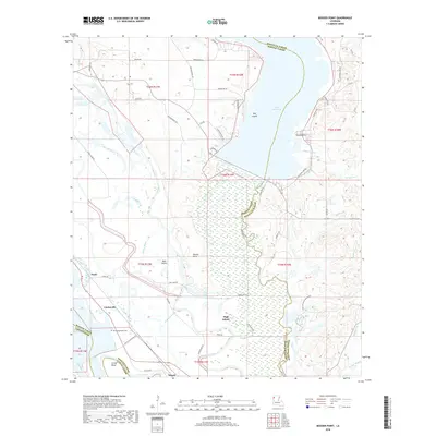
2018 Map of Bossier Point
USGS Topo · Published 2018About this map
The low-lying wetlands where the Red River meets Lake Bistineau define this part of the Louisiana landscape, showing a complex network of waterways at the border of Bossier, Caddo, and Bienville parishes. Small settlements like Cooterville, Ninock, and Poole are situated near the banks, reflecting the historic reliance on the river and rail corridors. The presence of the Mary Magdalene Cem provides a specific point of interest for genealogists researching the local families of this riverine district.
Find a feature on this map
64 named features on this map. Tap any name to fly to it.
Don’t see what you’re looking for? This feature index may not catch every label — zoom into the map to look around manually.
Map Details
Editions of this 2018 Bossier Point Map
This is the sole edition of this map. No revisions or reprints were ever made.
Other maps of this area

1938 · Arnsberg
USGS Topo · 1:31,680

1941 · East Point
USGS Topo · 1:31,680

1941 · Bossier Point
USGS Topo · 1:31,680

1945 · Mansfield
USGS Topo · 1:62,500

1947 · Ringgold
USGS Topo · 1:62,500

1947 · Mansfield
USGS Topo · 1:62,500

1948 · Coushatta
USGS Topo · 1:62,500

1948 · Caspiana
USGS Topo · 1:62,500

1955 · Shreveport
USGS Topo · 1:250,000

1955 · Caspiana
USGS Topo · 1:62,500