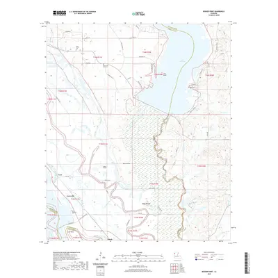
2020 Map of Bossier Point
USGS Topo · Published 2020About this map
Bossier Point and the surrounding marshy lowlands of the Red River valley are defined by a complex network of bayous and remnant river channels. This landscape, situated at the intersection of Bossier, Caddo, and Bienville Parishes, illustrates the historical reliance on elevated landforms such as High Island, Bear Island, and Hog Island for navigation and settlement. The movement of water is central to the area's character, with Mulberry Bayou and Horgis Bayou threading through the terrain, while the massive Lake Bistineau dominates the eastern boundary.
Find a feature on this map
64 named features on this map. Tap any name to fly to it.
Don’t see what you’re looking for? This feature index may not catch every label — zoom into the map to look around manually.
Map Details
Editions of this 2020 Bossier Point Map
This is the sole edition of this map. No revisions or reprints were ever made.
Other maps of this area

1938 · Arnsberg
USGS Topo · 1:31,680

1941 · East Point
USGS Topo · 1:31,680

1941 · Bossier Point
USGS Topo · 1:31,680

1945 · Mansfield
USGS Topo · 1:62,500

1947 · Ringgold
USGS Topo · 1:62,500

1947 · Mansfield
USGS Topo · 1:62,500

1948 · Coushatta
USGS Topo · 1:62,500

1948 · Caspiana
USGS Topo · 1:62,500

1955 · Shreveport
USGS Topo · 1:250,000

1955 · Caspiana
USGS Topo · 1:62,500