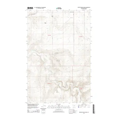
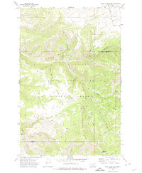
2014 Map of Boston Coulee School
USGS Topo · Published 2014About this map
The Smith River carves a deep, winding path through the heart of this landscape, creating a dramatic corridor through the high plains of Cascade County. This 2014 survey reveals a region defined by its complex drainage network, where numerous coulees—deep, often dry ravines—intersect the upland flats. To the north, Boston Coulee and Splain Coulee reach toward the river, while Murphy Coulee, Rocky Coulee, and Chicken Coulee mark the transition toward the central and southern reaches. The road system, including Boston Coulee Rd and the various branches of Eden Rd, traces the higher ground between these drainages. This cartographic study illustrates the classic Montana pattern of large-scale land management, where township boundaries like t17n r3e and t16n r4e organize a vast terrain defined by its water-carved topography.
Find a feature on this map
14 named features on this map. Tap any name to fly to it.
Don’t see what you’re looking for? This feature index may not catch every label — zoom into the map to look around manually.
Map Details
Editions of this 2014 Boston Coulee School Map
This is the sole edition of this map. No revisions or reprints were ever made.
Other maps of this area

1886 · Great Falls
USGS Topo · 1:250,000

1954 · Great Falls
USGS Topo · 1:250,000

1955 · Stockett
USGS Topo · 1:62,500

1955 · Gore Hill
USGS Topo · 1:62,500

1957 · Great Falls
USGS Topo · 1:250,000

1965 · Eden
USGS Topo · 1:24,000
1965 · Stockett
USGS Topo · 1:24,000
1965 · Truly
USGS Topo · 1:24,000
1971 · Boston Coulee School
USGS Topo · 1:24,000
1971 · Deep Creek Park
USGS Topo · 1:24,000