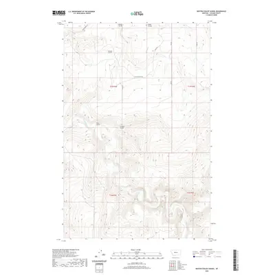
2020 Map of Boston Coulee School
USGS Topo · Published 2020About this map
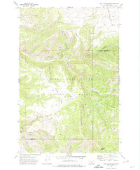
The Boston Coulee School serves as a central landmark in this portion of Cascade County, where the high plains are deeply incised by the winding course of the Smith River. This 2020 survey reveals a landscape defined by its drainage patterns, with numerous named coulees—steep-walled valleys or drainage-ways—branching out from the river valley. Notable geographic features include Boston Coulee, Murphy Coulee, and Splain Coulee in the north, while Rocky Coulee and Chicken Coulee dominate the central terrain. The road network, including Boston Coulee Rd and several branches of Eden Rd, follows the higher ground between these drainages, illustrating the historical and modern challenge of traversing this dissected Montana topography. The map detail reflects a contemporary look at rural land divisions and the enduring placement of local educational sites amidst the open range.
Find a feature on this map
16 named features on this map. Tap any name to fly to it.
Don’t see what you’re looking for? This feature index may not catch every label — zoom into the map to look around manually.
Map Details
Editions of this 2020 Boston Coulee School Map
This is the sole edition of this map. No revisions or reprints were ever made.
Other maps of this area

1886 · Great Falls
USGS Topo · 1:250,000

1954 · Great Falls
USGS Topo · 1:250,000

1955 · Stockett
USGS Topo · 1:62,500

1955 · Gore Hill
USGS Topo · 1:62,500

1957 · Great Falls
USGS Topo · 1:250,000

1965 · Eden
USGS Topo · 1:24,000
1965 · Stockett
USGS Topo · 1:24,000
1965 · Truly
USGS Topo · 1:24,000
1971 · Boston Coulee School
USGS Topo · 1:24,000
1971 · Deep Creek Park
USGS Topo · 1:24,000