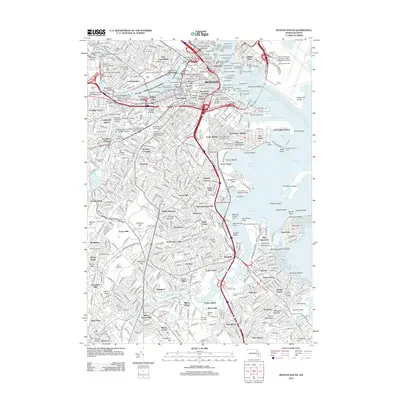
2012 Map of Boston South
USGS Topo · Published 2012About this map
The dense urban fabric of Boston and its surrounding neighborhoods is meticulously detailed in this early 21st-century record. The map spans from the historic heights of Beacon Hill and the academic campuses of Harvard Univ and Mit in the north, down through the residential grids of Dorchester and Jamaica Plain. The waterfront is a central focus, illustrating the industrial and logistical infrastructure of Boston Inner Harbor with its numerous piers, including the Mystic Piers and Constitution Wharf. Local history and genealogy interest is particularly high due to the identification of several colonial-era landmarks, including the Granary Burying Ground and Copps Hill Burying Ground. Southward, the landscape transitions toward the Neponset River and the distinct peninsulas of Squantum and City Point, providing a comprehensive view of the city's complex coastal geography and established transportation corridors like the Mbta rail lines.
Find a feature on this map
215 named features on this map. Tap any name to fly to it.
Don’t see what you’re looking for? This feature index may not catch every label — zoom into the map to look around manually.
Map Details
Editions of this 2012 Boston South Map
This is the sole edition of this map. No revisions or reprints were ever made.
Other maps of this area

1885 · Abington
USGS Topo · 1:62,500

1886 · Dedham
USGS Topo · 1:62,500

1888 · Abington
USGS Topo · 1:62,500

1892 · Boston Bay
USGS Topo · 1:62,500

1893 · Abington
USGS Topo · 1:62,500

1893 · Boston
USGS Topo · 1:62,500

1894 · Dedham
USGS Topo · 1:62,500

1903 · Boston
USGS Topo · 1:62,500

1903 · Boston Bay
USGS Topo · 1:62,500

1919 · Dedham
USGS Topo · 1:62,500