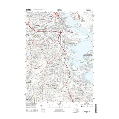
2015 Map of Boston South
USGS Topo · Published 2015About this map
Beacon Hill and the dense urban core of the city anchor this topographic study, where the historic shoreline meets modern infrastructure at the height of the mid-2010s. The landscape is a corridor of higher education and civic heritage, spanning from Harvard Univ and the Massachusetts Institute of Technology along the Charles River to the storied grounds of the Boston National Historical Park. Geologists and historians can trace the transition from the colonial-era burials at Granary Burying Ground and Copps Hill Burying Ground to the industrial waterfronts of the Reserved Channel and Old Harbor. Neighborhoods like Roxbury, Dorchester, and Jamaica Plain are meticulously detailed, showing the intricate street grids that replaced earlier agrarian layouts. To the south, the Neponset River winds through Mattapan and Lower Mills, marking the boundary toward the heights of Quincy.
Find a feature on this map
164 named features on this map. Tap any name to fly to it.
Don’t see what you’re looking for? This feature index may not catch every label — zoom into the map to look around manually.
Map Details
Editions of this 2015 Boston South Map
This is the sole edition of this map. No revisions or reprints were ever made.
Other maps of this area

1885 · Abington
USGS Topo · 1:62,500

1886 · Dedham
USGS Topo · 1:62,500

1888 · Abington
USGS Topo · 1:62,500

1892 · Boston Bay
USGS Topo · 1:62,500

1893 · Abington
USGS Topo · 1:62,500

1893 · Boston
USGS Topo · 1:62,500

1894 · Dedham
USGS Topo · 1:62,500

1903 · Boston
USGS Topo · 1:62,500

1903 · Boston Bay
USGS Topo · 1:62,500

1919 · Dedham
USGS Topo · 1:62,500