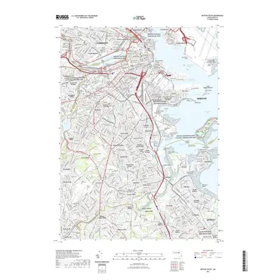
2021 Map of Boston South
USGS Topo · Published 2021About this map
Boston National Historical Park and the historic waterfront of the Charles River anchor this detailed study of the urban landscape. The dense street grids of Cambridge, Roxbury, and South Boston are meticulously documented, showing the evolution of these historic neighborhoods through the early 21st century. Along the shorelines of Dorchester Bay and the Old Harbor, the map reveals the complex industrial and residential infrastructure that defines the modern harbor, including the General Edward Lawrence Logan International Airport and Bird Island Flats.
Find a feature on this map
201 named features on this map. Tap any name to fly to it.
Don’t see what you’re looking for? This feature index may not catch every label — zoom into the map to look around manually.
Map Details
Editions of this 2021 Boston South Map
This is the sole edition of this map. No revisions or reprints were ever made.
Other maps of this area

1885 · Abington
USGS Topo · 1:62,500

1886 · Dedham
USGS Topo · 1:62,500

1888 · Abington
USGS Topo · 1:62,500

1892 · Boston Bay
USGS Topo · 1:62,500

1893 · Abington
USGS Topo · 1:62,500

1893 · Boston
USGS Topo · 1:62,500

1894 · Dedham
USGS Topo · 1:62,500

1903 · Boston
USGS Topo · 1:62,500

1903 · Boston Bay
USGS Topo · 1:62,500

1919 · Dedham
USGS Topo · 1:62,500