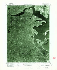
1977 Map of Boston South
USGS Topo · Published 1980About this map
The Boston metropolitan waterfront and its dense urban corridors are captured in high detail through this late-1970s orthophotoquad, which uses aerial photography from the Department of Public Works to show the city's physical form. The image clearly depicts the industrial piers and shipping berths lining Boston Harbor and the residential density of the surrounding neighborhoods. The Charles River separates the primary city center from Cambridge, while the southern reaches are defined by the winding course of the Neponset River. This perspective reveals the complex intersection of 20th-century highway infrastructure and traditional coastal geography near Dorchester Bay and the peninsula of Squantum, providing a clear look at the city's layout before the major transformations of the late 20th century.
Find a feature on this map
7 named features on this map. Tap any name to fly to it.
Don’t see what you’re looking for? This feature index may not catch every label — zoom into the map to look around manually.
Map Details
Editions of this 1977 Boston South Map
This is the sole edition of this map. No revisions or reprints were ever made.
Other maps of this area

1885 · Abington
USGS Topo · 1:62,500

1886 · Dedham
USGS Topo · 1:62,500

1888 · Abington
USGS Topo · 1:62,500

1892 · Boston Bay
USGS Topo · 1:62,500

1893 · Abington
USGS Topo · 1:62,500

1893 · Boston
USGS Topo · 1:62,500

1894 · Dedham
USGS Topo · 1:62,500

1903 · Boston
USGS Topo · 1:62,500

1903 · Boston Bay
USGS Topo · 1:62,500

1919 · Dedham
USGS Topo · 1:62,500