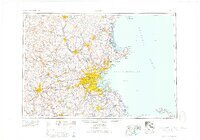
1958 Map of Boston
USGS Topo · Published 1958About this map
Boston and the surrounding industrial corridor of the late 1950s appear here in transition, showing the density of eastern Massachusetts just before the peak of suburban expansion. The map details a complex web of coastal defenses and maritime landmarks, including Fort Independence, Fort Warren, and the prominent lighthouse at Minot. This survey captures the region's heavy reliance on its river systems, from the power-generating Merrimack River supporting Lowell and Lawrence to the inland reaches of the Blackstone River near Woonsocket.
Find a feature on this map
248 named features on this map. Tap any name to fly to it.
Don’t see what you’re looking for? This feature index may not catch every label — zoom into the map to look around manually.
Map Details
Editions of this 1958 Boston Map
2 editions found

Other maps of this area

1885 · Abington
USGS Topo · 1:62,500

1885 · Duxbury
USGS Topo · 1:62,500

1885 · Worcester
USGS Topo · 1:62,500

1885 · Middleboro
USGS Topo · 1:62,500

1885 · Taunton
USGS Topo · 1:62,500

1886 · Gloucester
USGS Topo · 1:62,500

1886 · Lawrence
USGS Topo · 1:62,500

1886 · Worcester
USGS Topo · 1:62,500

1886 · Blackstone
USGS Topo · 1:62,500

1886 · Plymouth
USGS Topo · 1:62,500