
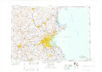
1958 Map of Boston
USGS Topo · Published 1958About this map
The Merrimack River valley and the industrial heart of New England define this mid-century portrait of eastern Massachusetts and southern New Hampshire. Centered on the dense urban core of Boston, the map illustrates a region in transition as postwar suburbanization begins to follow the path of major transit arteries like Mass. 128 and U.S. 1. The coastal defense network is prominent throughout Massachusetts Bay, with numerous installations such as Fort Warren, Fort Independence, and Fort Banks guarding the harbor approaches.
Find a feature on this map
65 named features on this map. Tap any name to fly to it.
Don’t see what you’re looking for? This feature index may not catch every label — zoom into the map to look around manually.
Map Details
Editions of this 1958 Boston Map
2 editions found
Other maps of this area

1885 · Abington
USGS Topo · 1:62,500

1885 · Duxbury
USGS Topo · 1:62,500

1885 · Worcester
USGS Topo · 1:62,500

1885 · Middleboro
USGS Topo · 1:62,500

1885 · Taunton
USGS Topo · 1:62,500

1886 · Gloucester
USGS Topo · 1:62,500

1886 · Lawrence
USGS Topo · 1:62,500

1886 · Worcester
USGS Topo · 1:62,500

1886 · Blackstone
USGS Topo · 1:62,500

1886 · Plymouth
USGS Topo · 1:62,500