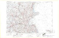
1961 Map of Boston
USGS Topo · Published 1961About this map
The industrial corridor of the Merrimack and Charles River valleys appears in high detail during the early 1960s, showing the dense network of roads and rails connecting Boston to regional hubs like Worcester and Lowell. This period of post-war suburbanization is evident in the expanding residential grids surrounding academic anchors like Tufts College and Wellesley College. Maritime and military history is densely packed along the coast, from the historic Bunker Hill Monument to the harbor defenses of Fort Independence and Fort Revere.
Find a feature on this map
519 named features on this map. Tap any name to fly to it.
Don’t see what you’re looking for? This feature index may not catch every label — zoom into the map to look around manually.
Map Details
Editions of this 1961 Boston Map
2 editions found

Other maps of this area

1885 · Abington
USGS Topo · 1:62,500

1885 · Duxbury
USGS Topo · 1:62,500

1885 · Worcester
USGS Topo · 1:62,500

1885 · Middleboro
USGS Topo · 1:62,500

1885 · Taunton
USGS Topo · 1:62,500

1886 · Gloucester
USGS Topo · 1:62,500

1886 · Lawrence
USGS Topo · 1:62,500

1886 · Worcester
USGS Topo · 1:62,500

1886 · Blackstone
USGS Topo · 1:62,500

1886 · Plymouth
USGS Topo · 1:62,500