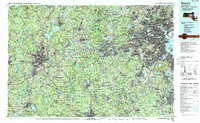
1989 Map of Boston
USGS Topo · Published 1989About this map
Industrial corridors and densely settled urban centers define this regional study of eastern Massachusetts as it appeared in the late 1980s. The landscape transitions from the dense coastal core of Boston and Cambridge to the satellite manufacturing hubs of Worcester and Woonsocket. Transport networks, including the Mbta and Conrail lines, link the Atlantic coast to the interior, where major waterworks like the Wachusett Reservoir and Lake Cochituate dominate the terrain.
Find a feature on this map
236 named features on this map. Tap any name to fly to it.
Don’t see what you’re looking for? This feature index may not catch every label — zoom into the map to look around manually.
Map Details
Editions of this 1989 Boston Map
2 editions found
Other maps of this area

1885 · Abington
USGS Topo · 1:62,500

1885 · Worcester
USGS Topo · 1:62,500

1885 · Middleboro
USGS Topo · 1:62,500

1885 · Taunton
USGS Topo · 1:62,500

1886 · Lawrence
USGS Topo · 1:62,500

1886 · Worcester
USGS Topo · 1:62,500

1886 · Blackstone
USGS Topo · 1:62,500

1886 · Dedham
USGS Topo · 1:62,500

1886 · Lowell
USGS Topo · 1:62,500

1886 · Framingham
USGS Topo · 1:62,500