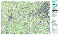
1989 Map of Boston
USGS Topo · Published 1989About this map
Boston and its dense surrounding metropolitan landscape are captured here during a period of significant late-20th-century expansion. The map illustrates the complex infrastructure connecting the coastal hub to inland centers like Worcester and Framingham, defined by a maturing network of interstate highways including I-95 and the Mass Pike. Beyond the urban core of Cambridge and Somerville, the preservation of green space is evident in the Blue Hills Reservation and the Middlesex Fells Reservation, alongside the sprawling waters of the Wachusett Reservoir.
Find a feature on this map
355 named features on this map. Tap any name to fly to it.
Don’t see what you’re looking for? This feature index may not catch every label — zoom into the map to look around manually.
Map Details
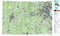
Editions of this 1989 Boston Map
2 editions found
Other maps of this area

1885 · Abington
USGS Topo · 1:62,500

1885 · Worcester
USGS Topo · 1:62,500

1885 · Middleboro
USGS Topo · 1:62,500

1885 · Taunton
USGS Topo · 1:62,500

1886 · Lawrence
USGS Topo · 1:62,500

1886 · Worcester
USGS Topo · 1:62,500

1886 · Blackstone
USGS Topo · 1:62,500

1886 · Dedham
USGS Topo · 1:62,500

1886 · Lowell
USGS Topo · 1:62,500

1886 · Framingham
USGS Topo · 1:62,500