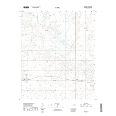
2018 Map of Boswell
USGS Topo · Published 2018About this map
The town of Boswell serves as the primary hub in this Oklahoma landscape, situated where local routes like North St and Main St intersect. This 2018 survey reveals a terrain defined by the complex hydrology of the Clear Boggy Creek and Muddy Boggy Creek watersheds. The area is characterized by an extensive network of wetlands and small lakes, including Hogpen Lake, Salt Lake, and Mosley Lake, which illustrate the slow-moving, meandering nature of the creek systems. For those researching local families, the map identifies several rural burying grounds such as Pierce Cem, Holder Cem, and Wade Cem near the small settlement of Unger. The distribution of these cemeteries and the grid of section roads like Ross Rd and E 2070 Rd reflect a long-standing agricultural pattern and a decentralized community structure typical of Choctaw County.
Find a feature on this map
39 named features on this map. Tap any name to fly to it.
Don’t see what you’re looking for? This feature index may not catch every label — zoom into the map to look around manually.
Map Details
Editions of this 2018 Boswell Map
This is the sole edition of this map. No revisions or reprints were ever made.
Other maps of this area

1901 · Antlers
USGS Topo · 1:125,000

1903 · Paris
USGS Topo · 1:125,000

1912 · Antlers
USGS Topo · 1:125,000

1925 · Antlers
USGS Topo · 1:125,000

1948 · Grant
USGS Topo · 1:62,500

1948 · Direct
USGS Topo · 1:62,500

1949 · Direct
USGS Topo · 1:62,500

1949 · Grant
USGS Topo · 1:62,500

1950 · Mcalester
USGS Topo · 1:250,000

1953 · Texarkana
USGS Topo · 1:250,000