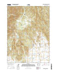
2017 Map of Boswell Mountain
USGS Topo · Published 2017About this map
Boswell Mountain dominates the northeast corner of this terrain in northern Jackson County, where the landscape transitions from the high peaks of Cinnabar Mtn and Hull Mtn into the managed water systems of the Sams Valley area. The map illustrates a complex network of reservoirs and water management, featuring named bodies such as the Sams Valley Reservoir, Gribble Reservoir, and the tiered Coulter Reservoir Number One and Number Two near Chimney Rock Butte. Settlement is sparse, anchored by the community of Beagle and the Antioch Cem near Antioch Rd. Aviation is surprisingly well-represented in this rural corridor, with Snider Creek Airport, Sky Ranch Airport, and Firefly Ranch Airfield all situated within a few miles of each other along the flatlands east of Snider Cr. Local history is preserved in labels like Meadow Graves and the many family-named landmarks like Neil Rock and Turtle Rock.
Find a feature on this map
76 named features on this map. Tap any name to fly to it.
Don’t see what you’re looking for? This feature index may not catch every label — zoom into the map to look around manually.
Map Details
Editions of this 2017 Boswell Mountain Map
This is the sole edition of this map. No revisions or reprints were ever made.
Other maps of this area

1891 · Ashland
USGS Topo · 1:250,000

1893 · Ashland
USGS Topo · 1:250,000

1897 · Ashland
USGS Topo · 1:250,000

1904 · Riddle
USGS Topo · 1:125,000

1908 · Grants Pass
USGS Topo · 1:125,000

1938 · Medford
USGS Topo · 1:125,000

1943 · Trail
USGS Topo · 1:62,500

1954 · Medford
USGS Topo · 1:62,500

1954 · Gold Hill
USGS Topo · 1:62,500

1954 · Wimer
USGS Topo · 1:62,500