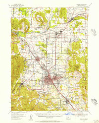
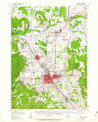
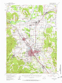
1954 Map of Medford
USGS Topo · Published 1956About this map
The Rogue River defines the northern reaches of this mid-century landscape, flowing past the prominent volcanic plateaus of Upper Table Rock and Lower Table Rock. To the south, the city of Medford serves as the regional hub, its grid extending toward the Southern Pacific rail line and the historic Jacksonville. The area shows a transition from the agricultural expanses of the Agate Desert and the river valley to the more industrial and military influences near White City, where the Veterans Hosp and various warehouses are located. Local history is deeply embedded in the rural infrastructure, including several family and community landmarks like Pankey Park Cemetery and the Table Rock School (Abandoned). The topography rises sharply at Roxy Ann Peak to the east and Johns Peak to the west, framing the valley floor where the Medford Airport and Rodeo Grounds signal the town's mid-century development.
Find a feature on this map
62 named features on this map. Tap any name to fly to it.
Don’t see what you’re looking for? This feature index may not catch every label — zoom into the map to look around manually.
Map Details
Editions of this 1954 Medford Map
3 editions found
Other maps of this area

1891 · Ashland
USGS Topo · 1:250,000

1893 · Ashland
USGS Topo · 1:250,000

1897 · Ashland
USGS Topo · 1:250,000

1904 · Riddle
USGS Topo · 1:125,000

1908 · Grants Pass
USGS Topo · 1:125,000

1938 · Medford
USGS Topo · 1:125,000
1943 · Trail
USGS Topo · 1:62,500
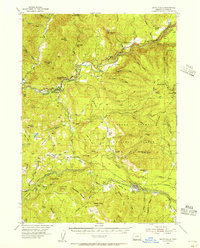
1954 · Butte Falls
USGS Topo · 1:62,500
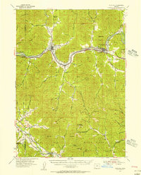
1954 · Gold Hill
USGS Topo · 1:62,500
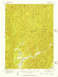
1954 · Wimer
USGS Topo · 1:62,500