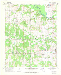
1969 Map of Boswell SW
USGS Topo · Published 1971About this map
Clear Boggy Creek defines the northern reaches of this landscape, winding through the Hunter and Matoy townships. The map documents a predominantly rural region of Oklahoma during the late 1960s, where small settlements and rural institutions like Timber Hill Ch and Pigeon Roost Ch served as local hubs. The southern portion of the sheet is anchored by the St Louis - San Francisco railroad corridor, which parallels the highway passing through Boswell. This transport network was essential for the movement of goods and people across Bryan and Choctaw counties. Smaller locales such as Cade and Mayhew appear as quiet crossroads, while landmarks like Timber Hill and Newkirk Lake provide topographic variety. Genealogists may find particular value in the locations of scattered sites like Jones Cem and the Homera Chapel, which highlight the social fabric of the era.
Find a feature on this map
28 named features on this map. Tap any name to fly to it.
Don’t see what you’re looking for? This feature index may not catch every label — zoom into the map to look around manually.
Map Details
Editions of this 1969 Boswell SW Map
This is the sole edition of this map. No revisions or reprints were ever made.
Other maps of this area

1899 · Atoka
USGS Topo · 1:125,000

1900 · Atoka
USGS Topo · 1:125,000

1901 · Antlers
USGS Topo · 1:125,000

1903 · Paris
USGS Topo · 1:125,000

1912 · Antlers
USGS Topo · 1:125,000

1925 · Antlers
USGS Topo · 1:125,000

1948 · Direct
USGS Topo · 1:62,500

1949 · Direct
USGS Topo · 1:62,500

1950 · Mcalester
USGS Topo · 1:250,000

1953 · Texarkana
USGS Topo · 1:250,000