2023 Map of Bothell
USGS Topo · Published 2023About this map
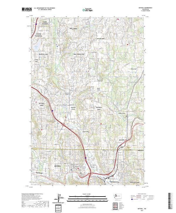
Bothell and its surrounding suburban centers across the Snohomish and King County line are captured in high detail, reflecting the modern evolution of the north Lake Washington corridor. The landscape is defined by the winding course of the Sammamish River and its major tributaries, including North Creek and Bear Creek. Educational and civic anchors are prominent, most notably the University of Washington Bothell Campus and Cascadia Community College located near the riverbanks. For those researching local history or genealogy, the map identifies several significant burial grounds such as Bothell Pioneer Cem, Woodinville Cem, and Floral Hills Cem. Residential developments and shopping hubs like Canyon Park, Thrashers Corner, and Mill Creek show the density of contemporary Puget Sound settlements.
Find a feature on this map
124 named features on this map. Tap any name to fly to it.
Don’t see what you’re looking for? This feature index may not catch every label — zoom into the map to look around manually.
Map Details
Editions of this 2023 Bothell Map
This is the sole edition of this map. No revisions or reprints were ever made.